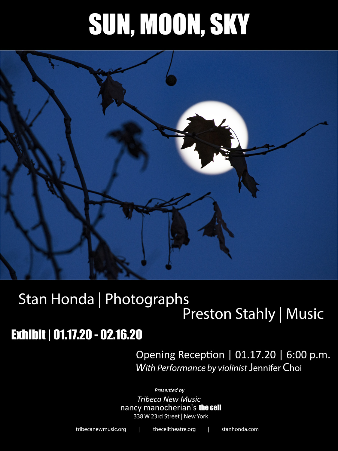
Join us for the opening of Sun, Moon, Sky, an exhibit of night sky landscapes by Stan Honda, on Friday, Jan. 17, 2020 presented by Tribeca New Music and nancy manocherian’s the cell. On display will be Stan’s striking images of the night sky, eclipses and the space shuttle.
The reception will feature a musical performance of Sapphireby Preston Stahly, inspired by a dawn astronomical twilight experienced at sea. It will be performed by violinist Jennifer Choi with a video of Stan’s images.
The exhibit runs until Feb. 6, the framed archival prints will be available for purchase. (The Cell is open Tuesday to Friday, 12:00 pm to 5:00 pm)
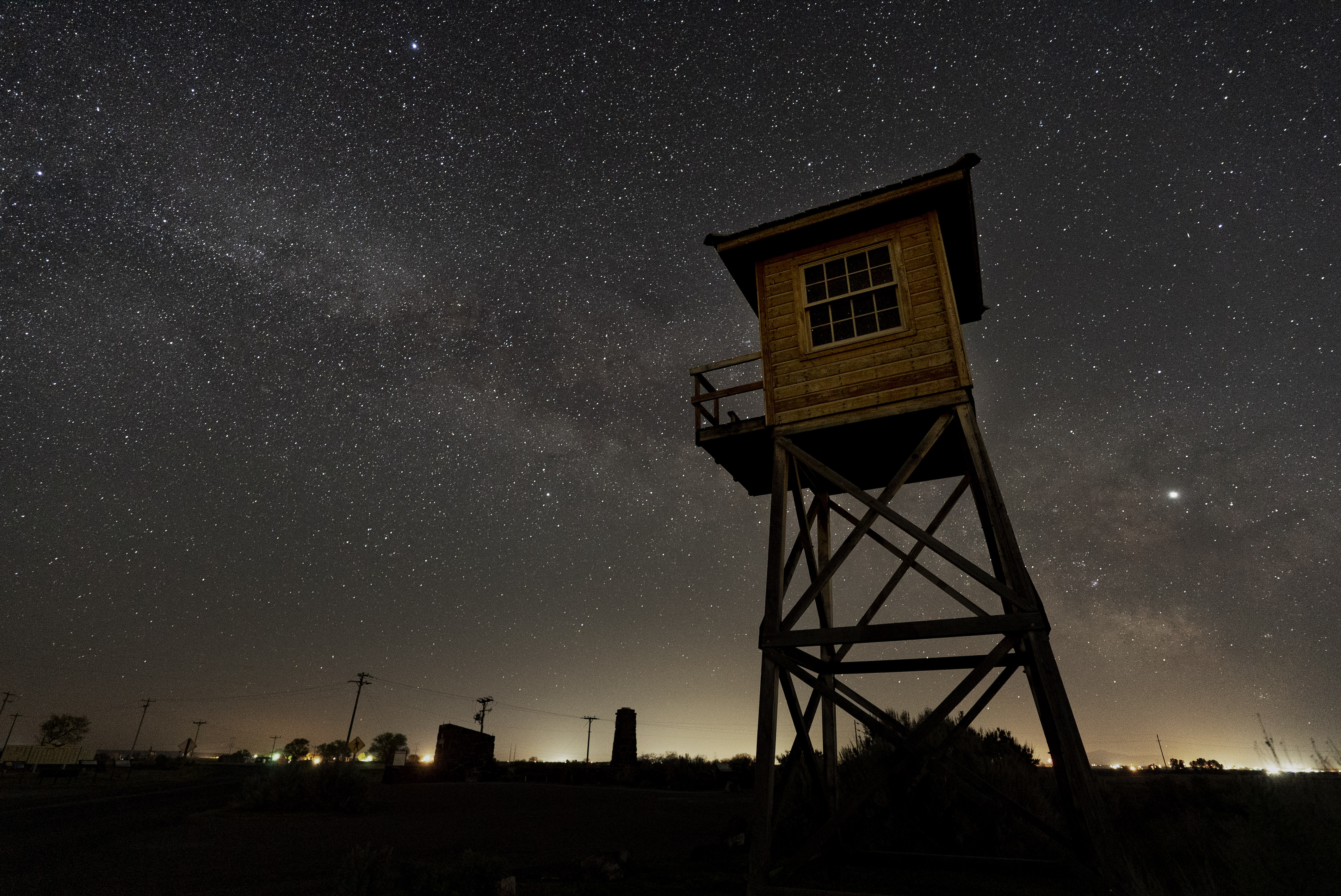
The guard tower and Milky Way. Bright object to the right is Jupiter. (Click on photo to enlarge)
One goal was to try and do some night sky photos of the structures at Minidoka. Thankfully, the site is far enough outside of Twin Falls that you get a good view of the stars and even the Milky Way. As you can see there is quite a bit of artificial light along the horizon from the outlying towns looking to the southeast (from the guard tower) but the view overhead is nice.
The tower and the fire station were taken on two separate night, both around 1:30 to 2:00 am in the early morning. The Milky Way rises about 1:00 am in early May and I thought that would make a good photo. Nearby lights from farms cast a faint glow on the tower and station. The nights I was there, it was very still though somewhat noisy due to the rush of the water in the irrigation canal which goes right by the guard tower.
While the stillness is similar to being there during the day, it was a different feeling being surrounded by the night sky and stars.
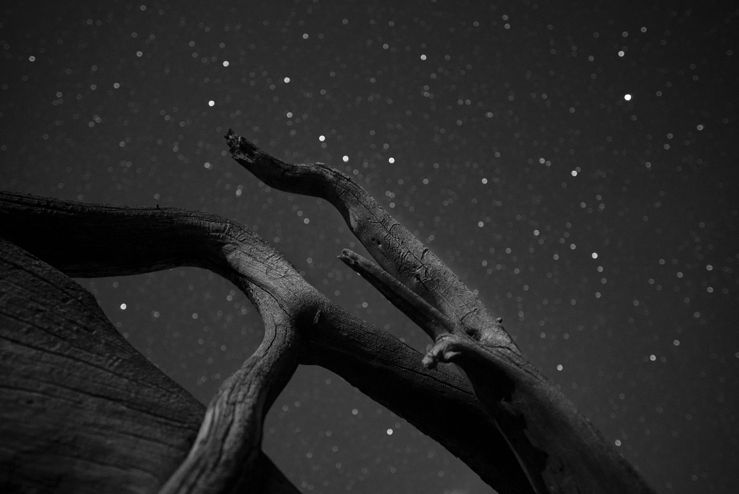
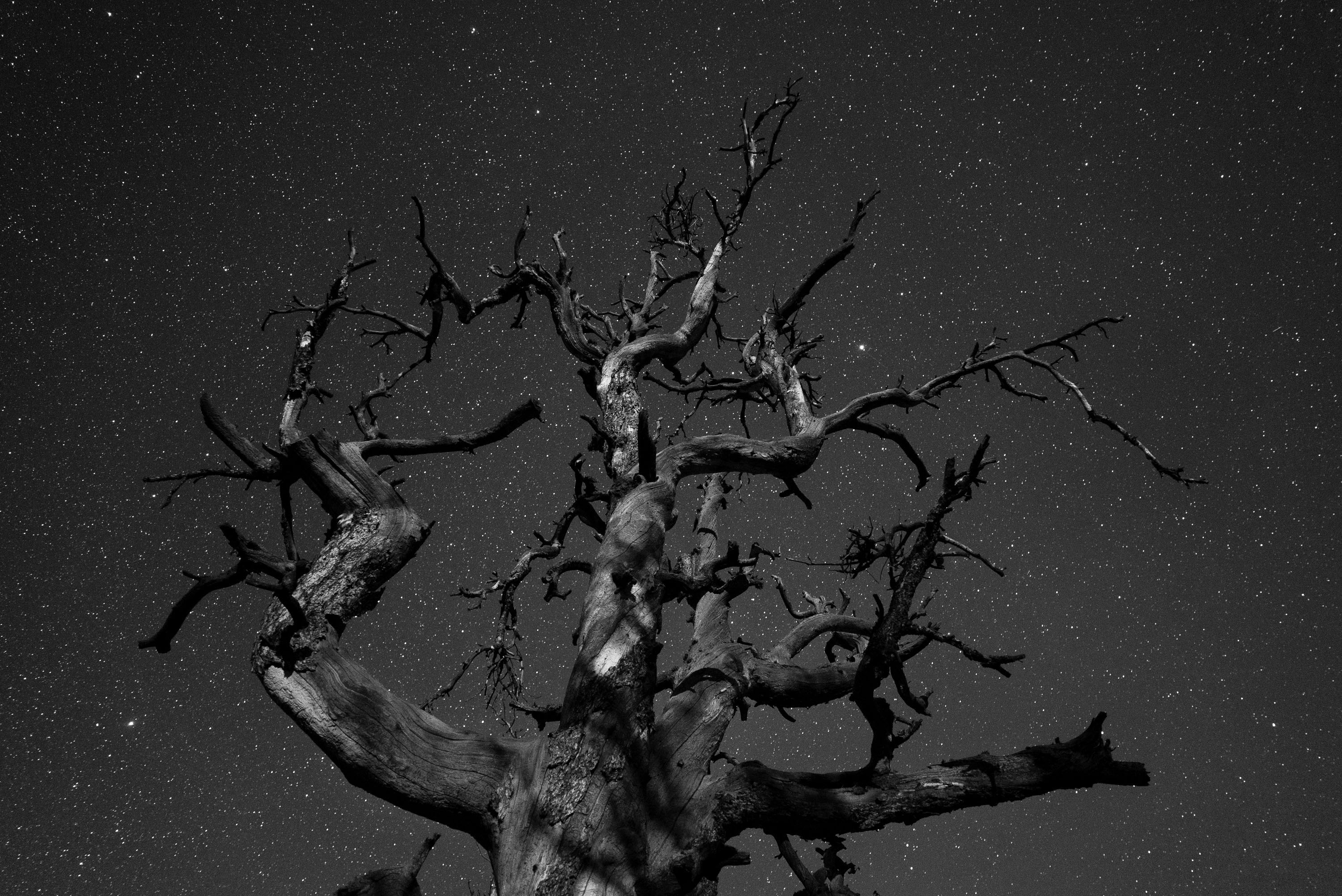
When researching the Idaho area, I saw Craters of the Moon National Monument on the map, close to Twin Falls. It sounds like a perfect place for the night sky landscapes so I took a two-day trip out there. Thanks to Janet from the Friends of Minidoka group, I stayed at her family’s cabin northwest of the park. (Friends of Minidoka co-sponsor a yearly pilgrimage to the site and work closely with the park service to support and help fund projects at the site. If you want to support the Minidoka site, the Friends group is a good one to donate to.)
Craters is a large volcanic lava field with an amazing landscape dotted with cinder cones and quite a bit of plant life. The ‘a’a lava (stony and rough) was familiar to me from my trip to Haleakala in Maui where I learned the two major types of lava, ‘a ‘a and pahoehoe, use Hawaiian terms to describe them.
The two pictures here are limber pines that grow in the park. The shapes of the branches are great and make for striking subjects. An almost first quarter moon lights up the gnarled pines against the starry sky. There was little color in the shots so I made them into black and white.
The fire station. The constellation Cassiopeia is right over the roof in the centerCraters of the Moon: The root of a limber pine lit by the moon with the Big Dipper.Craters of the Moon: Limber pine branches lit by the moon.
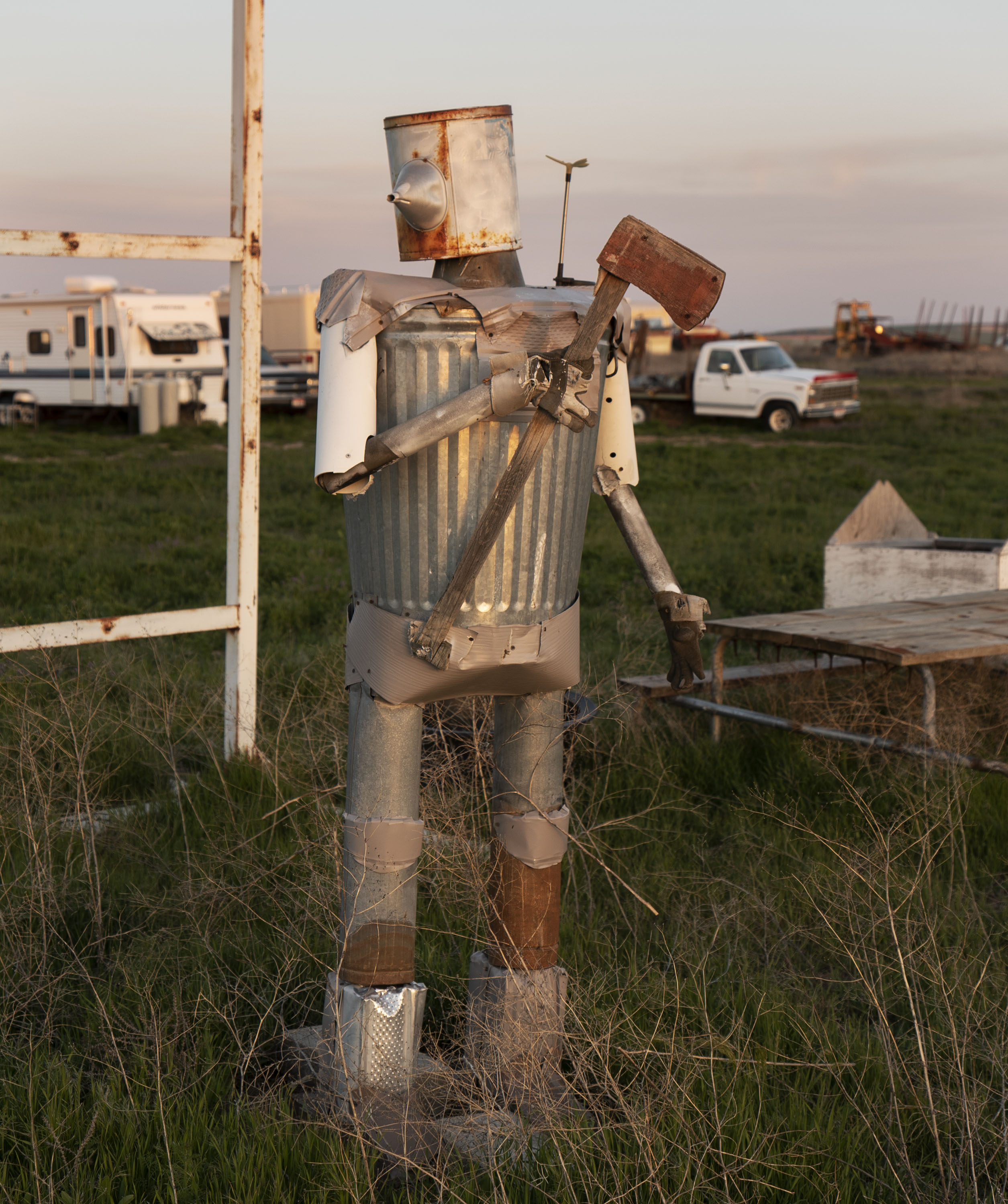
A mostly tin man, with axe, on Hunt Road, on the way to the Minidoka site. (Click on pictures to enlarge)
My photographer friend Ken and I (see his excellent blog, http://greatvisualtruths.blogspot.com/ ), along with Ann’s help, are on the lookout for photos of what we call the “American Vernacular”. Mostly scenes where you might say, “Only in America” or “Only in Idaho”. Hard to define but we know it when we see it. When I saw the tin man above, I knew it was the American Vernacular. This is on the road a few miles from the Minidoka site. It was a bit scary, as it is wielding an axe.
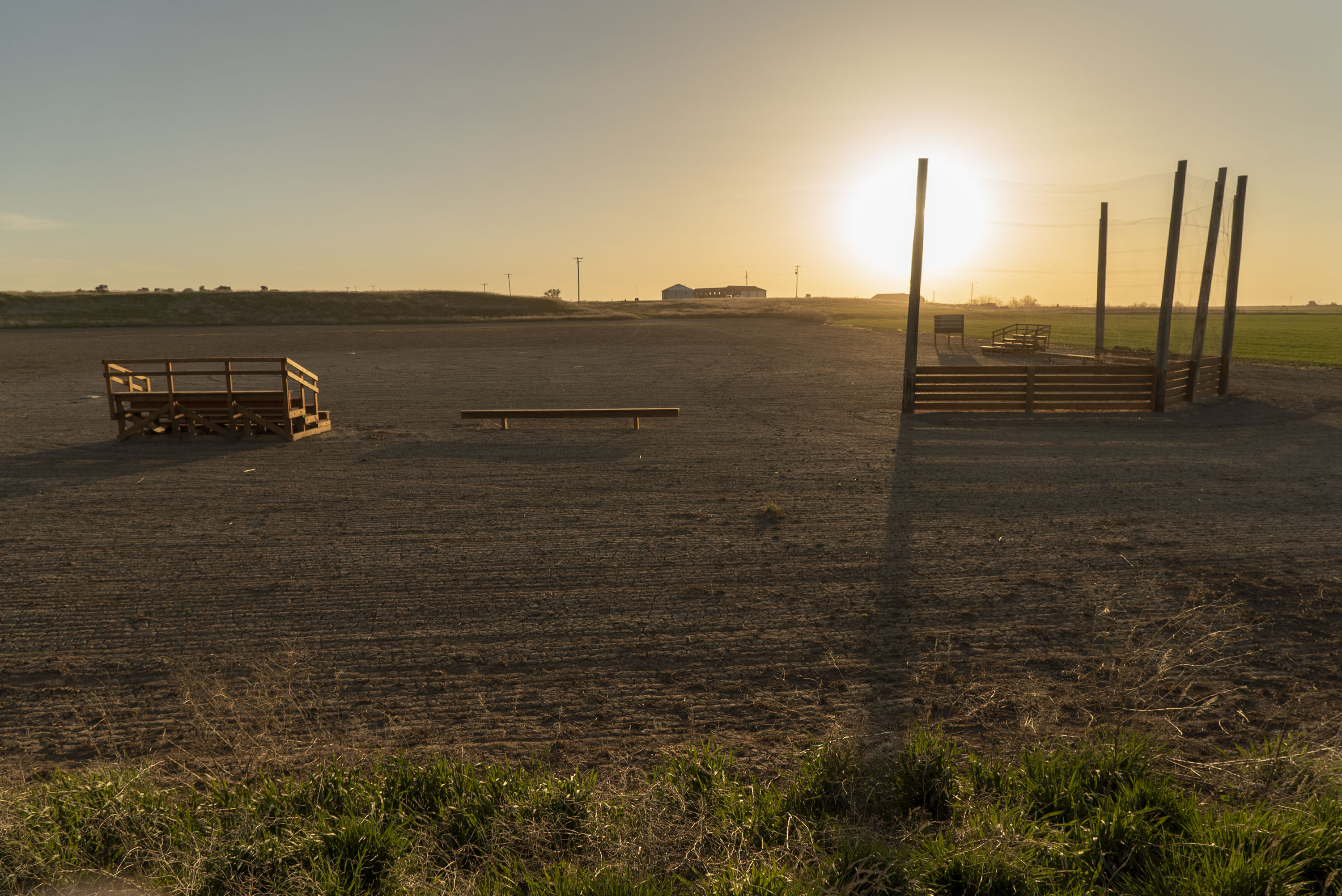
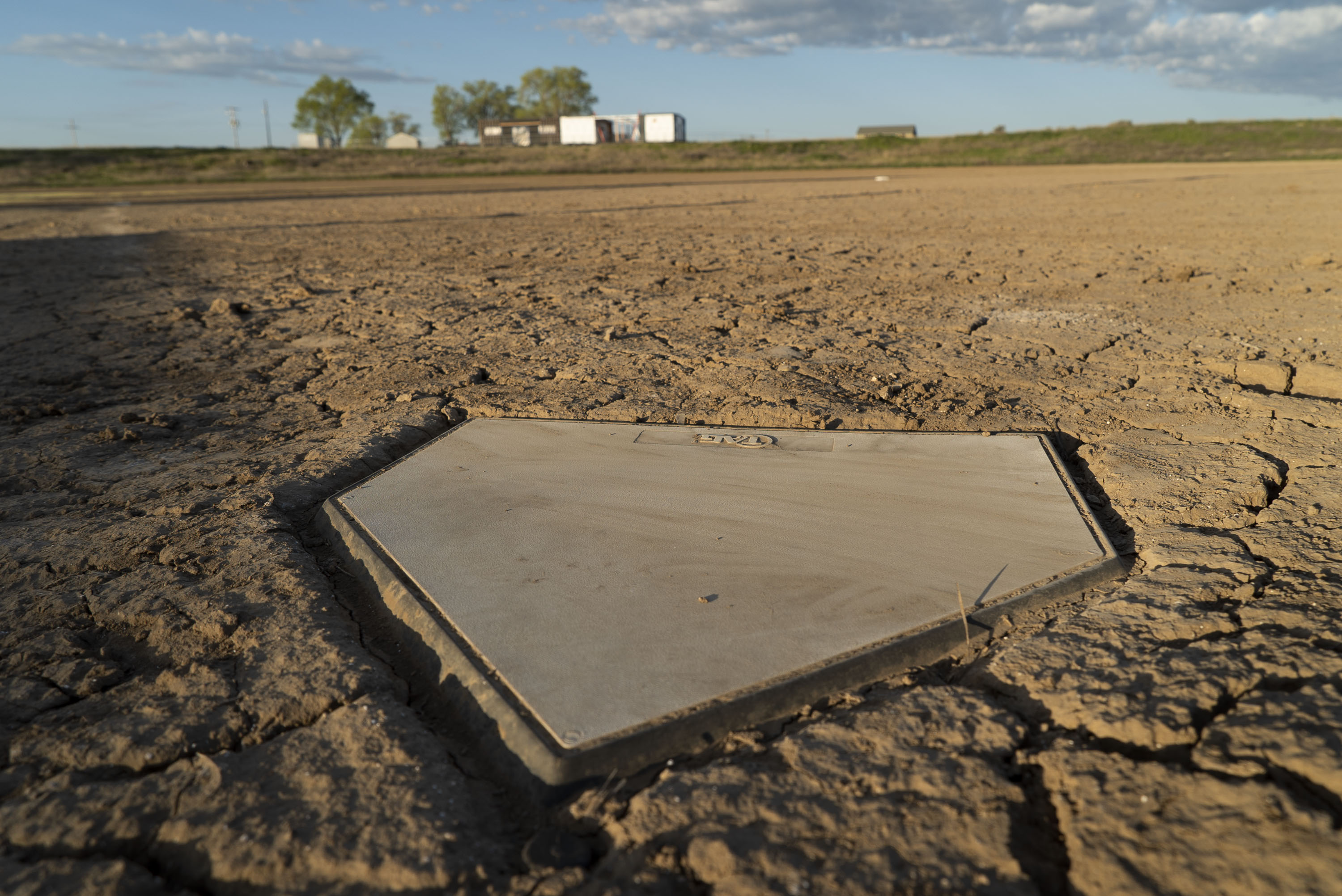
As with life everywhere, athletic activity is important to the community. Even more so at Minidoka and the other camps with the lack of a normal life. The park service has built a baseball field near Block 22 where they believe an original field existed. The simple backstop, wood stands and single bench for each team recalls the simple materials that must have been used by the incarcerees. Volunteers built this field in a single day with donated materials.
An interesting book for younger children (or even adults) is called “Baseball Saved Us” about the experiences of a boy in the Minidoka camp. Other books on baseball in the concentration camps are “A Diamond In the Desert” by Kathryn Fitzmaurice and “Nikkei Baseball” by Samuel Regalado.
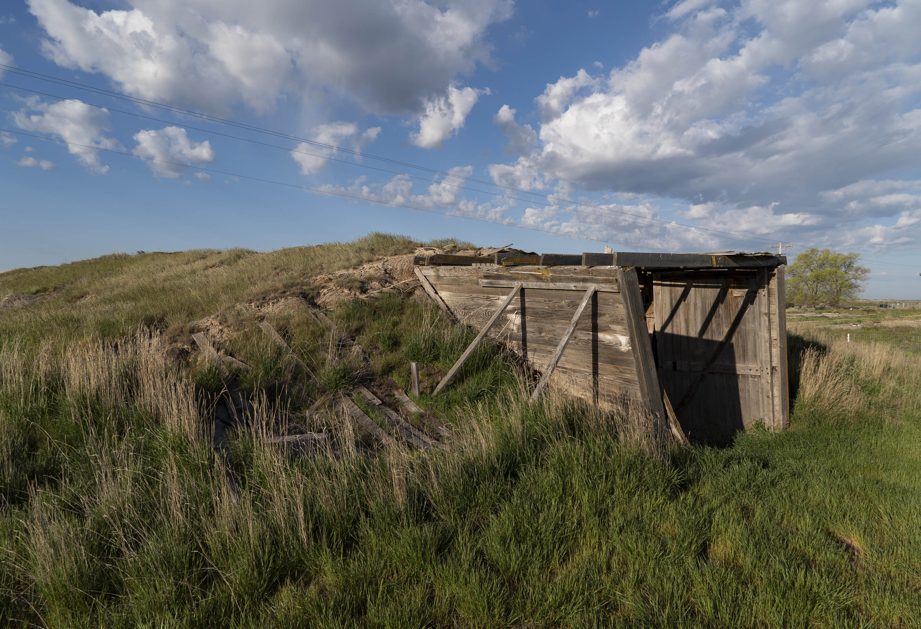
Food production was difficult during the war and each camp often had large areas set aside for agriculture. The camp administrators were not able to provide the usual foods that the Japanese Americans were used to except for rice. Many of the incarcerees were farmers and they began to grow crops that fed the entire camp. At Minidoka a root cellar was built, with timber poles, to store the harvests. It is partially underground with a roof covered with straw and ground cover. We got permission from the park service to go inside. I wore a hard hat in case anything loose fell on me. Emily, the intern, was posted outside in case anything happened. It was boring for her since nothing did happen.
Sunset over the baseball field. Early morning sun on home plate. A panoramic view inside the root cellar. There is an entrance at each end to the far left and far right. Horizontal lines get distorted in the creation of the wide view. One of the entrances to the root cellar.
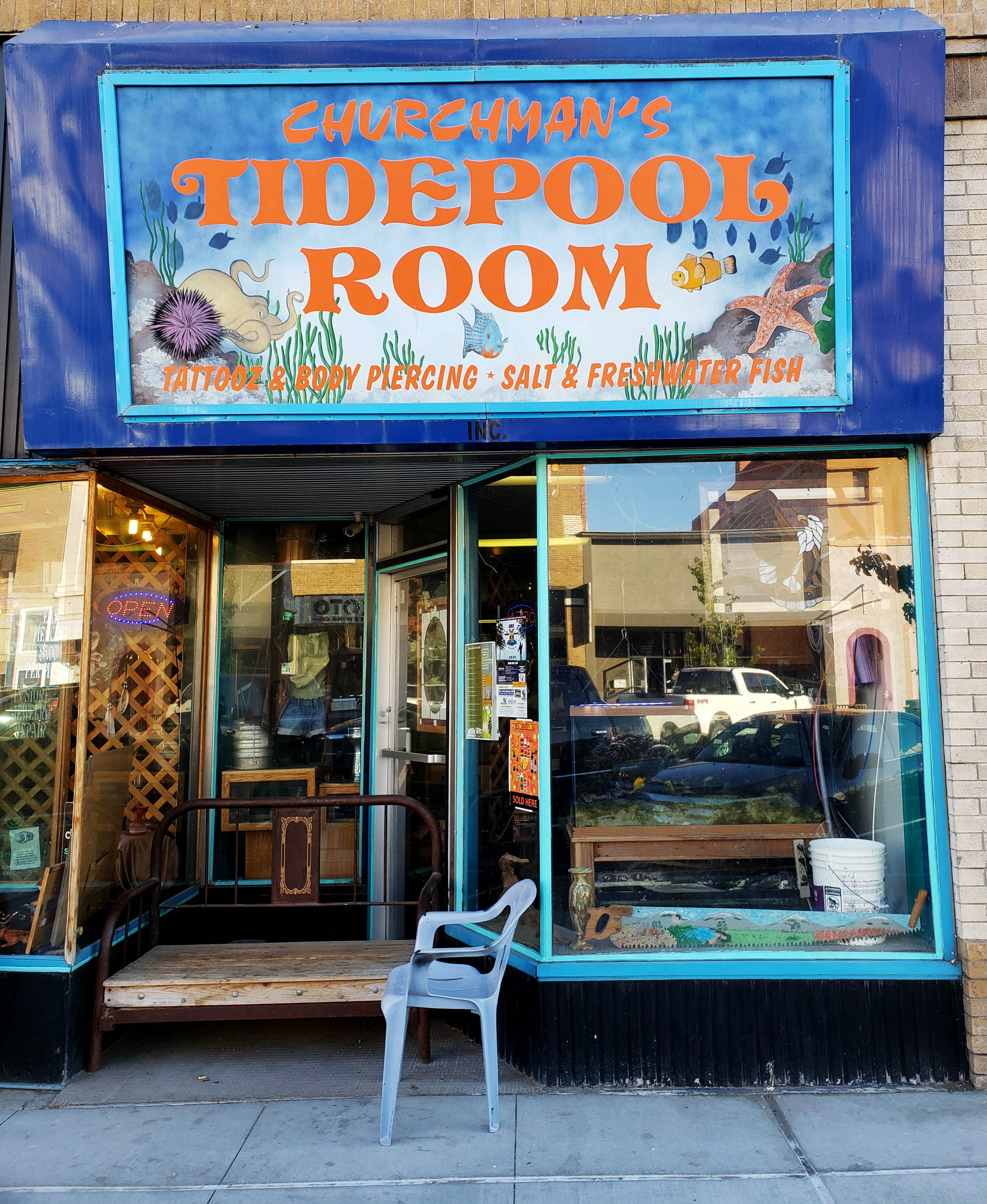
Last Saturday I joined Hanako and another park employee, Sam, at a local restaurant called Koto Brewery. Across the street was a really interesting business called Churchman’s Tidepool Room. Their sign says it is a, “Tattoz & Body Piercing * Salt and Freshwater Fish” as in aquariums. Quite a combo. I believe it is related to Churchman’s Jewelry & Idaho Artistry next door.
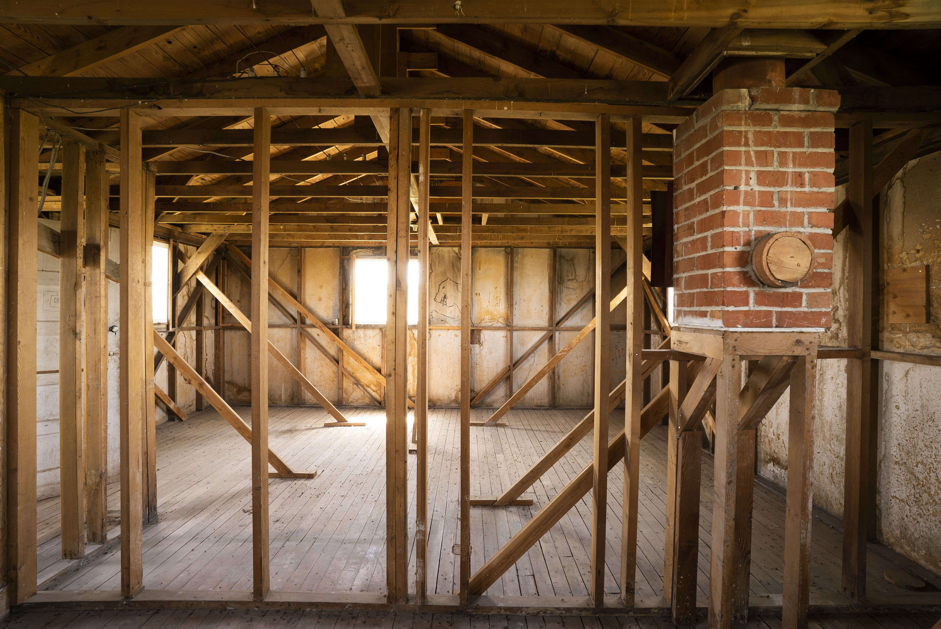
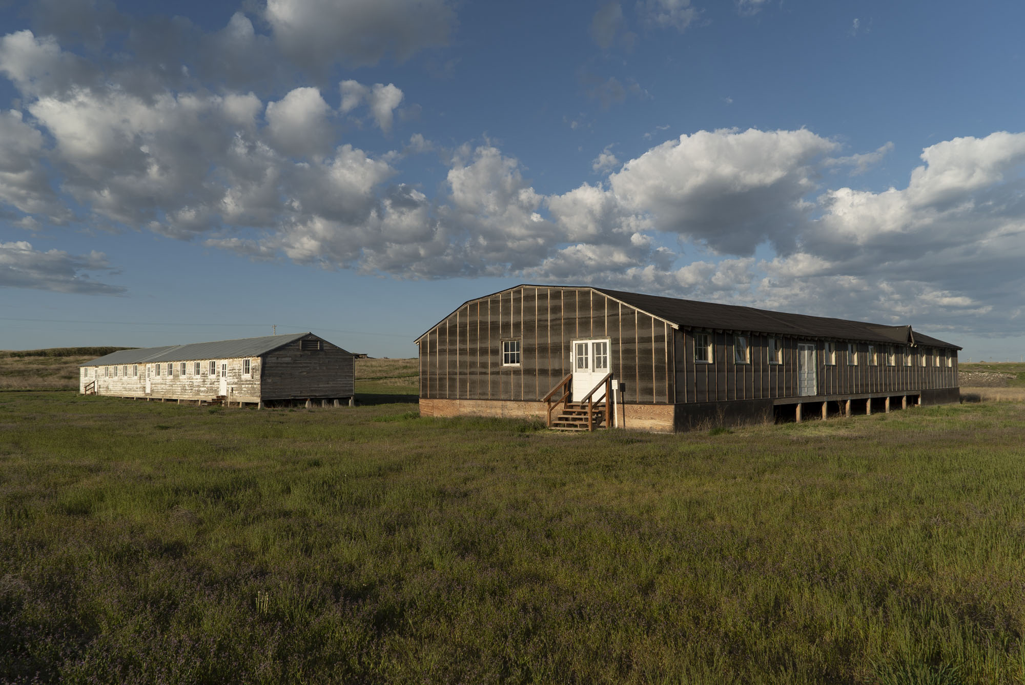
In the first picture below, you are looking at a single 16×20 feet room carved out of the barracks in Block 22 (the white structure in the “Americanism…” post). If you are a couple or family of three, you would be living in this space. There was a single wood or coal burning stove for heat that was attached to the chimney at right. There was no running water, bathroom or kitchen. Separate barracks buildings in the block housed latrines for women and men and a large mess hall for all meals. Most barracks had six units in the 120 foot long building the largest being 24 x 20 feet for a large family.
(The diagonal pieces of wood are being used to support the current day barrack and mess hall. At 77-years-old both are not completely structurally sound).
Living unit in the barrack for a small family. (click on images to enlarge)
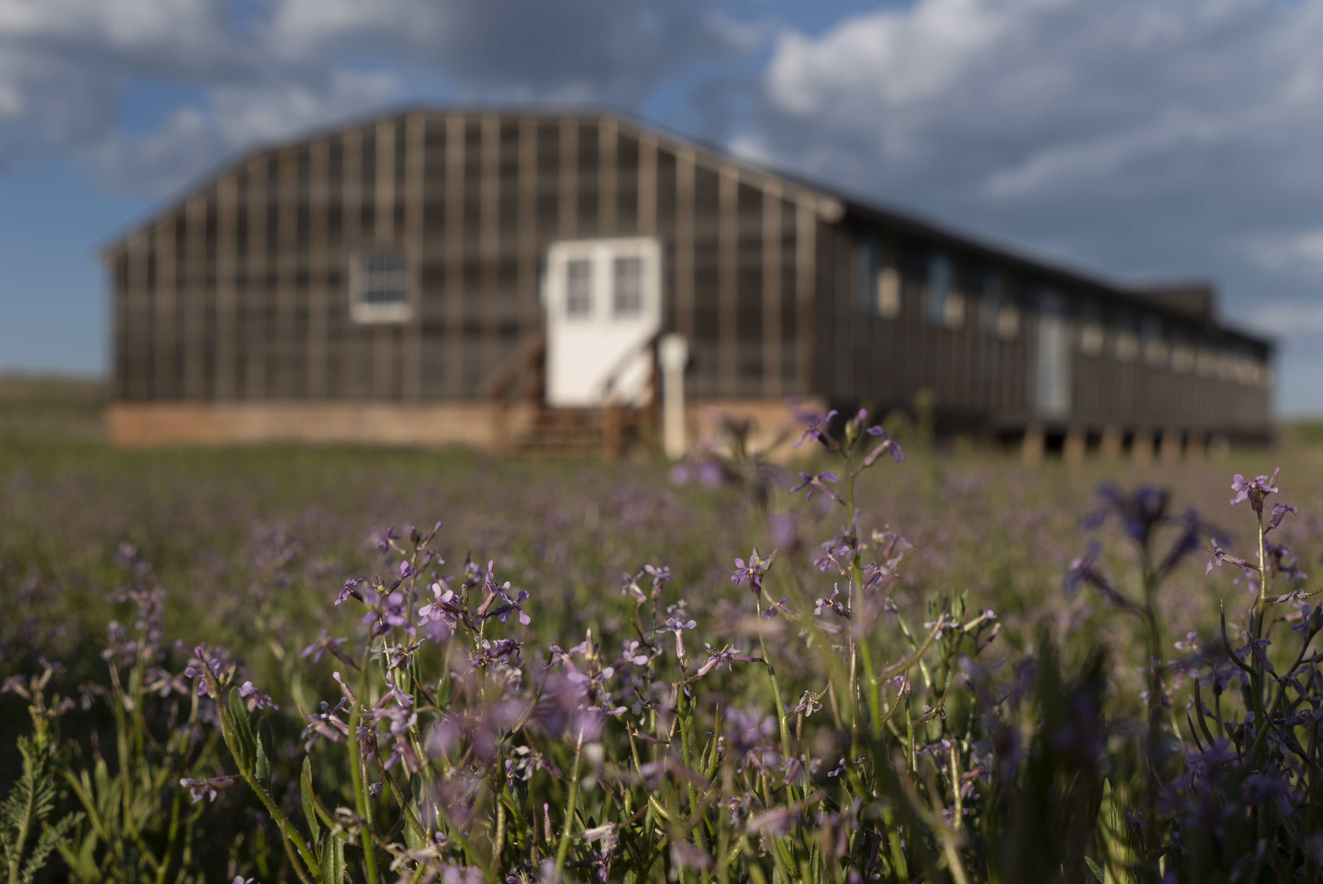
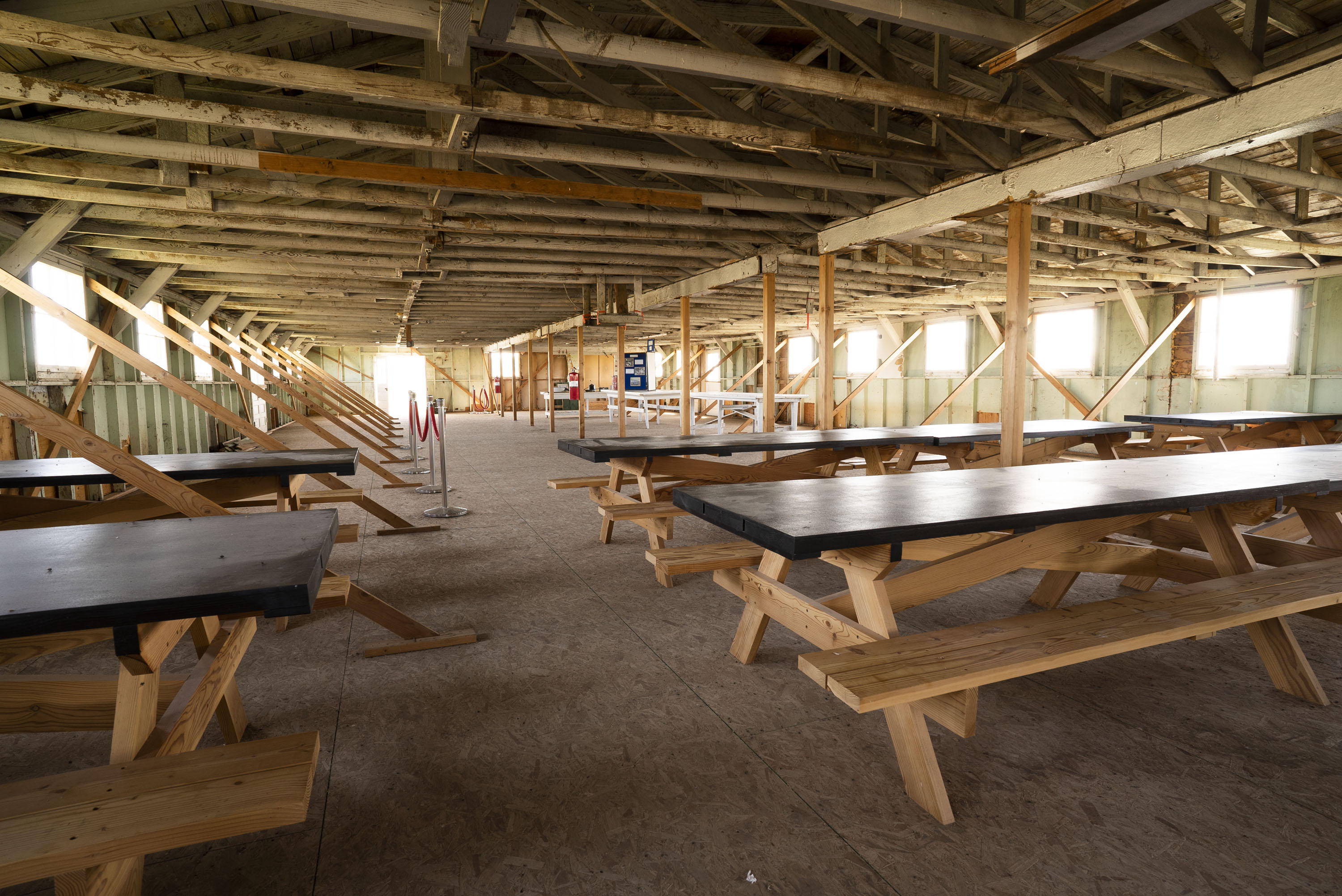
The mess hall is essentially a double-wide barrack. I’ve never seen one and this is an original building from Minidoka that had been used by a canning business and was moved back to the site. The park service restored the exterior in the same fashion as the fire station. Inside picnic-style tables recreating the original table are on display as well as period-style kitchen ware that matches what is seen in historical photos from the camp. It’s interesting to realize the group meals led to children often eating with their peers and not their families, leading to a breakdown in the family unit.
Purple flowers growing in the field with the mess hall.Interior of the mess hall with tables.Period kitchen ware on display. Similar items show up in historical photographs.
Minidoka rangers Hanako and Annette. (click on images to enlarge)
I thought I would introduce the two park service rangers I’ve been working with here at Minidoka, Hanako and Annette. They work out of a small temporary visitor center that used to be the house of the Hermann family who farmed 128 acres where the historical site is now situated. In addition to all their other duties, the rangers give tours of the site, lately to school groups that bring classes to learn about the camp. Hanako has a personal connection to the Japanese American experience—four generations of her family were incarcerated at the Manzanar (Calif.) concentration camp. Emily, an intern that just started, was helpful in photographing the two rangers and later made sure the root cellar didn’t collapse on me as I wandered inside it (a future blog post).
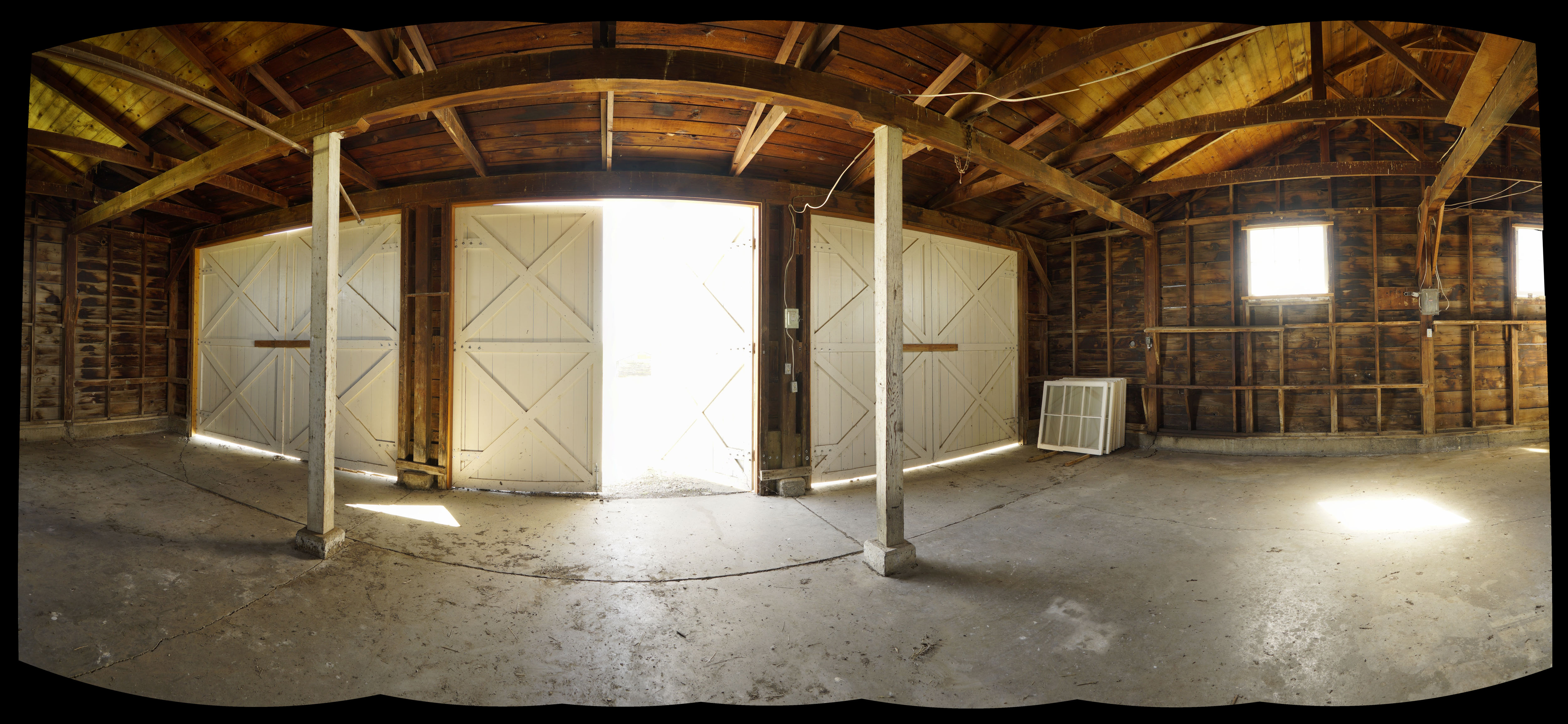
On to the virtual tour. In a town of almost 10,000 people where almost all of the buildings are made of wood, you need a fire station. Minidoka had two, this is Fire Station #1. When the Hermann family received this homestead in 1950, the fire station was still standing and they lived in the structure until their house was built. This is one of two original buildings at Minidoka that are still in their historic location.
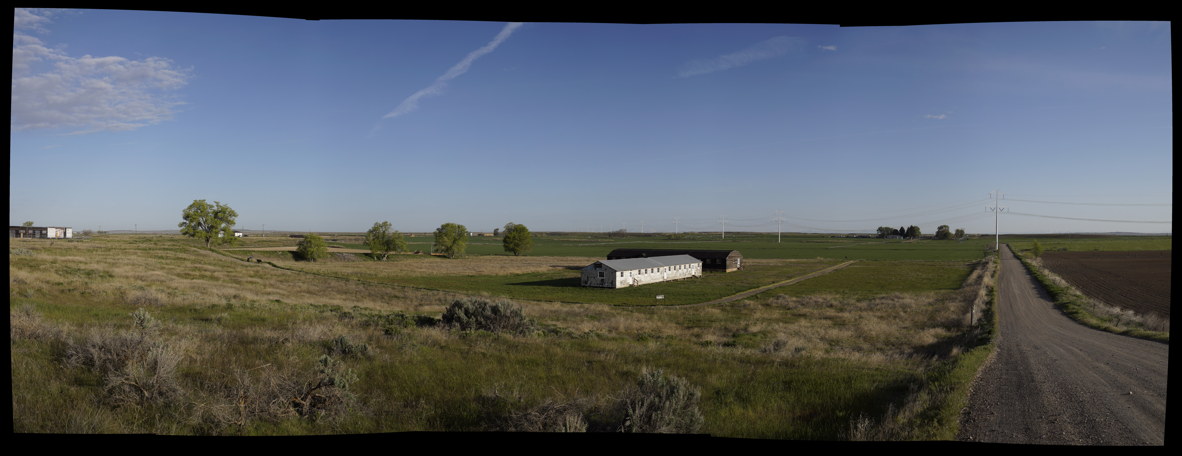
It’s essentially a barrack with an enlarged front to accommodate the fire trucks. The park service has nicely restored the exterior to as near original appearance as possible. For this project I decided to work on some panoramic photos to take in the wide expanse of these buildings and the site. The panoramas are composed of a series of vertical shots starting from the left and going to the right, usually about a span of 180 degrees. It’s really compressing onto a flat surface what your eyes naturally do. A result of this is distortion of straight lines, in this case the horizontal ones. This image used seven shots and were “stitched” together in a program called PTGui.
Intern Emily.
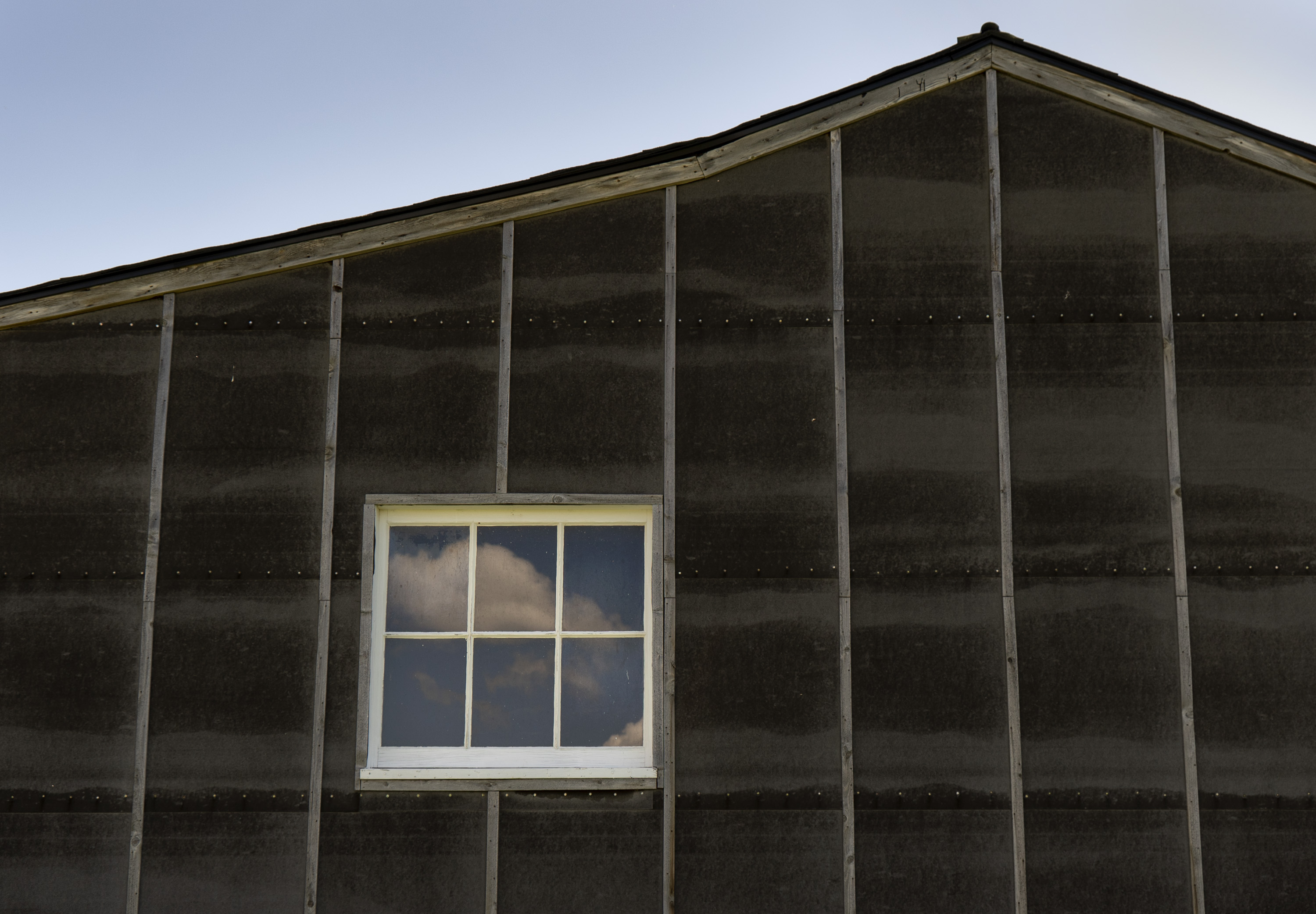
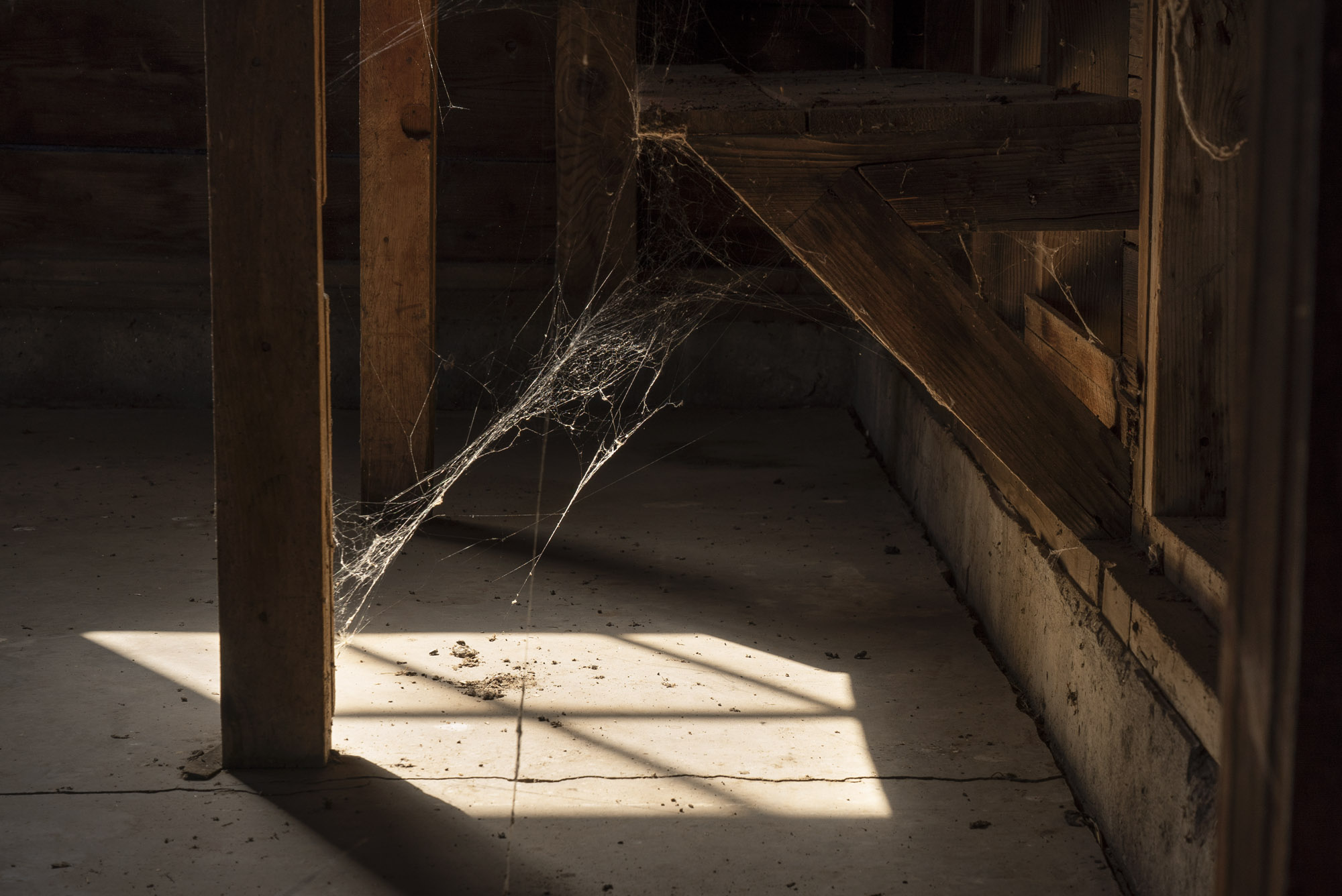
Panoramic view from the inside looking towards the big doors of the fire station A cloud is reflected in a fire station window.Hanako may not like this as she tidied up the floors for the photos, but I liked the light on the cobwebs.Fire Station #1.
A panoramic view of much of the historic site. (Click on images to enlarge)
As a historic site, Minidoka is doing an amazing job of telling the history of the camp, the daily life under pretty horrible conditions, and showing visitors a small part of what was at the time the 7th largest city in Idaho. In 1979 Minidoka was added to the National Register of Historic Places and in 2001 became the 385th unit of the National Park Service.
The panoramic shot above looks northwest from near the corner of Hunt Road and S 1450 E road and gives you an idea of the terrain at the site. Mostly flat and now mostly agriculture, 600 buildings were crowded onto 946 acres. In the center are a barrack (white structure) and a mess hall in the location of Block 22. All camps were divided into this “block” format, at Minidoka twelve barracks, a mess hall, latrine, showers and a recreation hall made up Block 22.
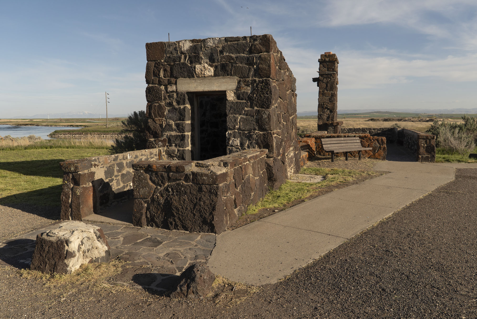
Near the guard tower pictured in the previous blog are the remains of a guard station at the original main entrance that monitored all movements in and out of Minidoka. Next to it is a waiting room for visitors who were allowed to see friends and family restricted to the camp.
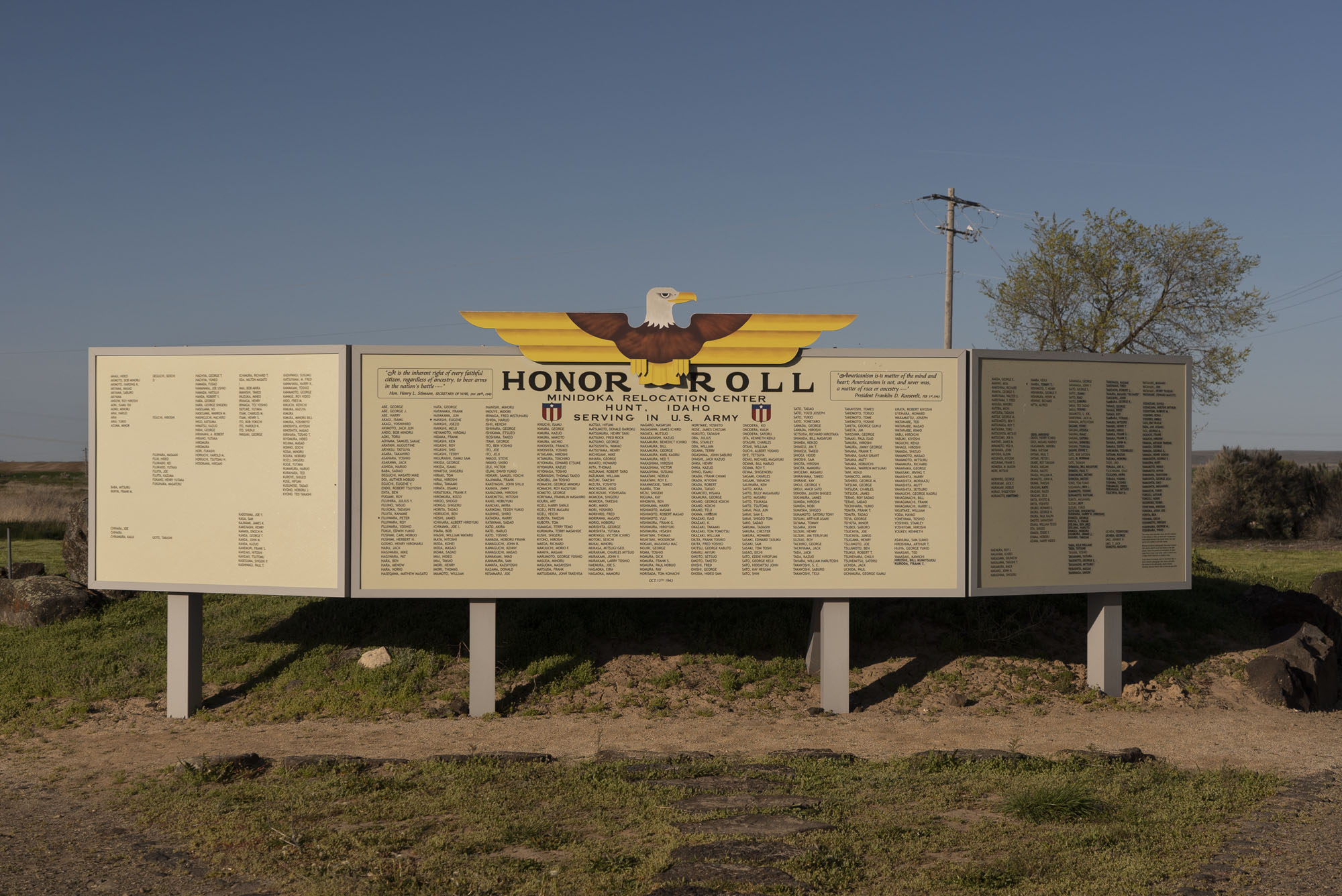
From this entrance is a 1.6 mile walking trail with very informative interpretive signs describing the location and daily life in the camp, many with historic photos. At the start of the trail is the reconstructed Honor Roll, which highlights the nearly 1,000 people from Minidoka that served in the U.S. military during WWII and commemorating those that died in the war.
An interesting quote on the Honor Roll is from Pres. Franklin Roosevelt, who a year earlier had signed Executive Order 9066 that lead to the mass incarceration of only Japanese Americans: “Americanism is a matter of the mind and heart; Americanism is not, and never was, a matter of race or ancestry….” FDR, Feb 1, 1943
A barrack (left) and mess hall (right) in Block 22. For scale, the barrack is 120 feet long and 20 feet wide. The guard station and behind it the waiting room at the original main entrance. The reconstructed Honor Roll.
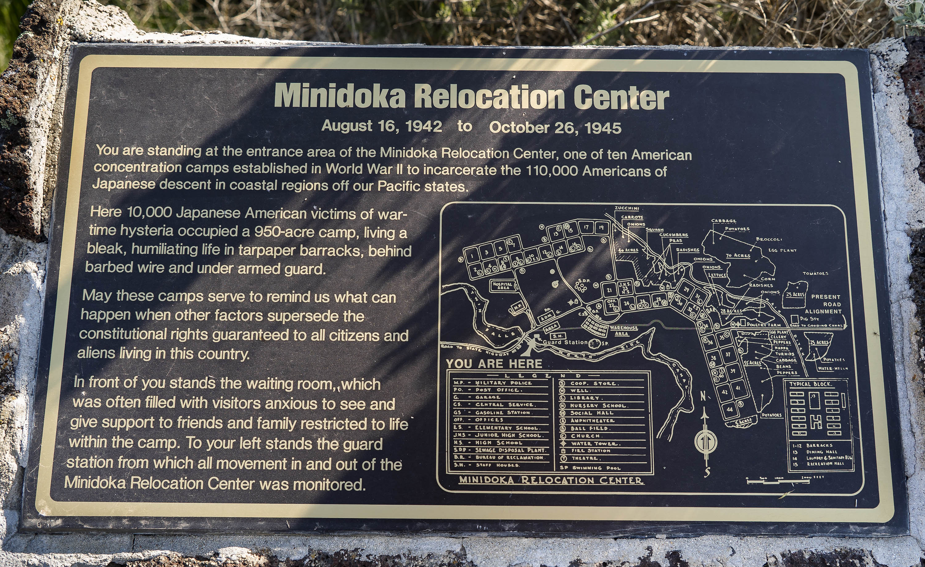
I’m standing in the high desert of southern Idaho twelve miles northeast of Twin Falls. The sun is bright and puffy clouds gather on the eastern horizon. I’m reading a plaque that marks the Minidoka Relocation Center, a concentration camp that incarcerated Japanese Americans during World War II. It is one of the most direct and unvarnished views of the incarceration that I’ve seen at many of these camps. Please read the text in the photo above to get an impression of the history and location.
I’m here for two weeks to document the buildings at the Minidoka National Historic Site for the park, which is run by the National Park Service. Chief interpretation ranger Hanako Wakatsuki invited me out to work on this project. I hope to also photograph some of the camp barracks that are scattered around the counties here that have been used as storage or out buildings by homesteading farmers.
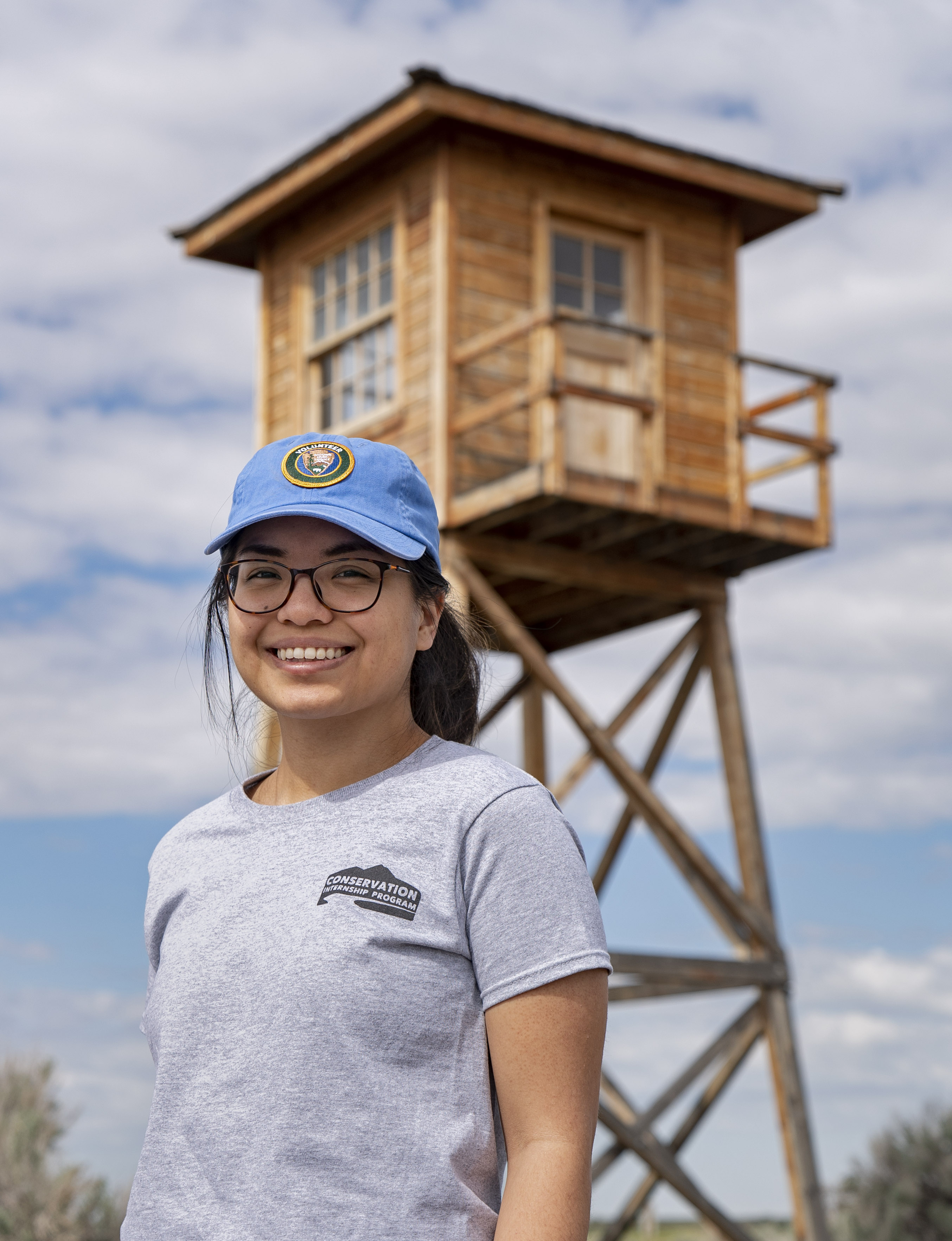
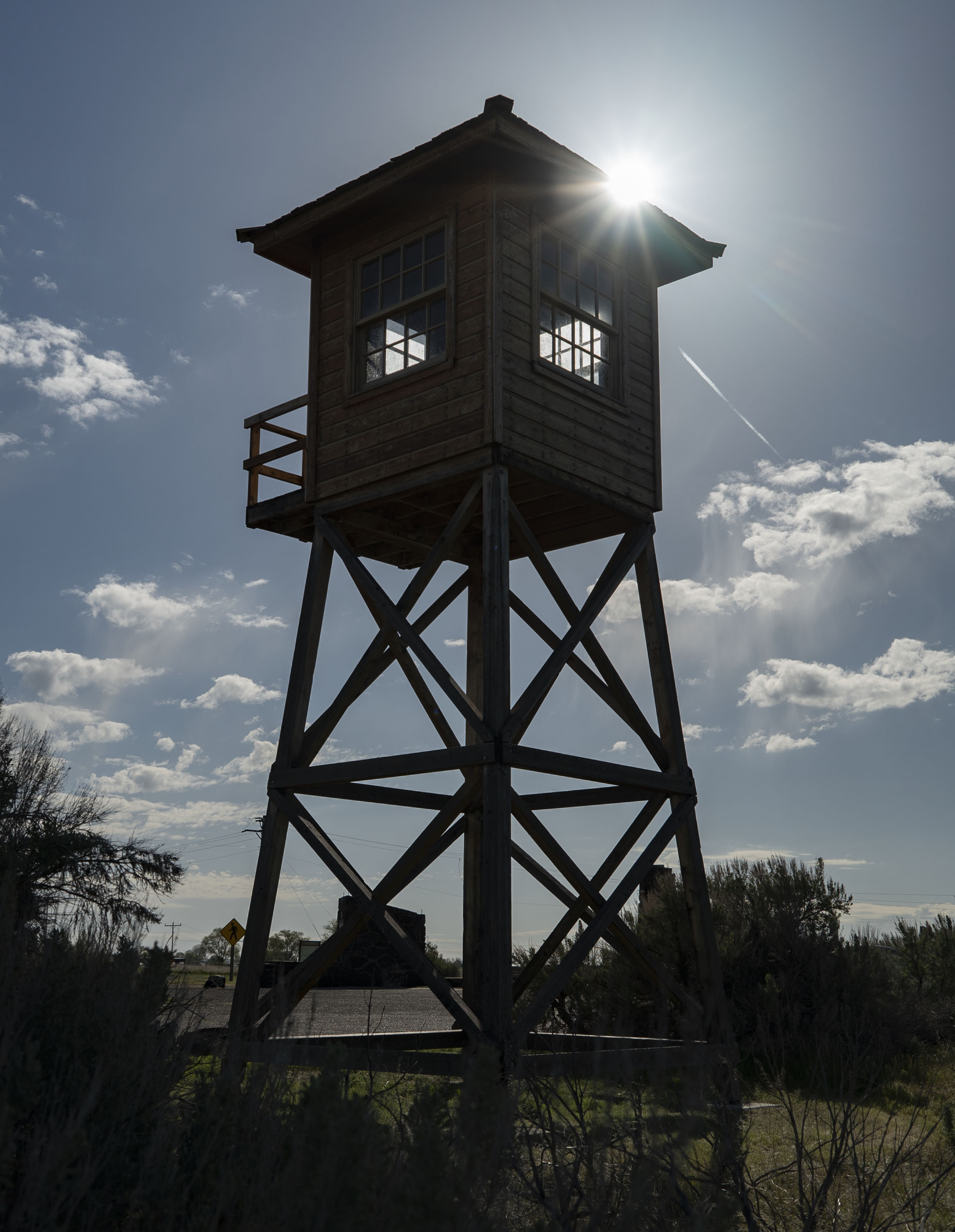
The small parking area is described as the camp entrance and from 1942-45 it was the actual entry to Minidoka. Remnants of a reception center and military police building are there, informational plaques, an honor roll of incarcerees that served in the U.S. military during WWII and a recently reconstructed guard tower looming over the entrance.
An interesting quote is included on a panel: “The sentry towers are always silhouetted in the distance. It is not enough that they are not being used—to the residents they stand waiting for the day when they will be used. The eight sentry towers are ever present as a symbol of their confinement….no other single factor has had a serious effect on the residents’ morale as the erection of the guard tower.”—War Relocation Authority, 1943 (The administering government department).
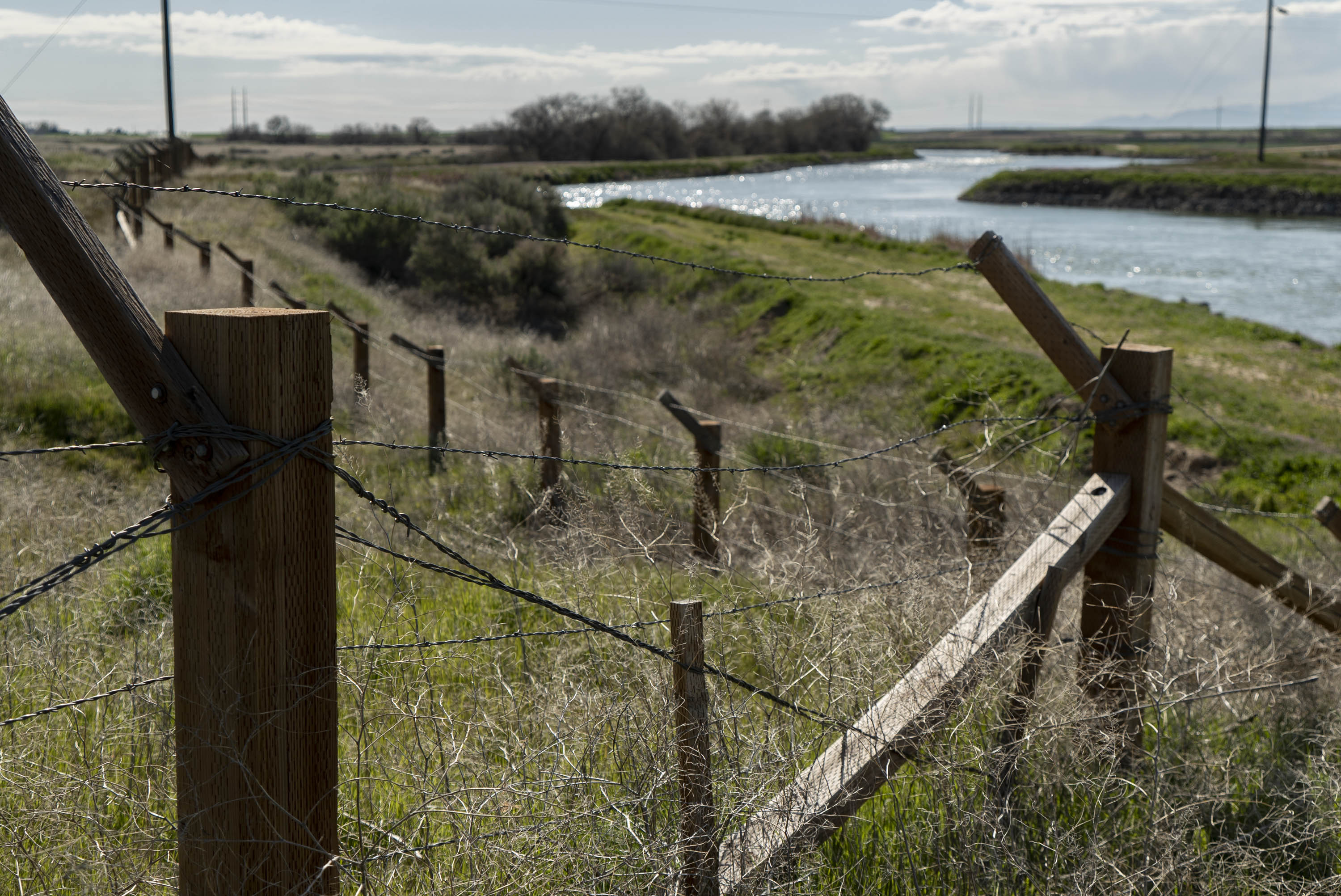
The guard tower was reconstructed in 2014 by students in Boise State University’s Dept. of Construction Management program. A facsimile of a barbed wire fence was constructed along a canal near the entrance, where a fence would have been during the war.
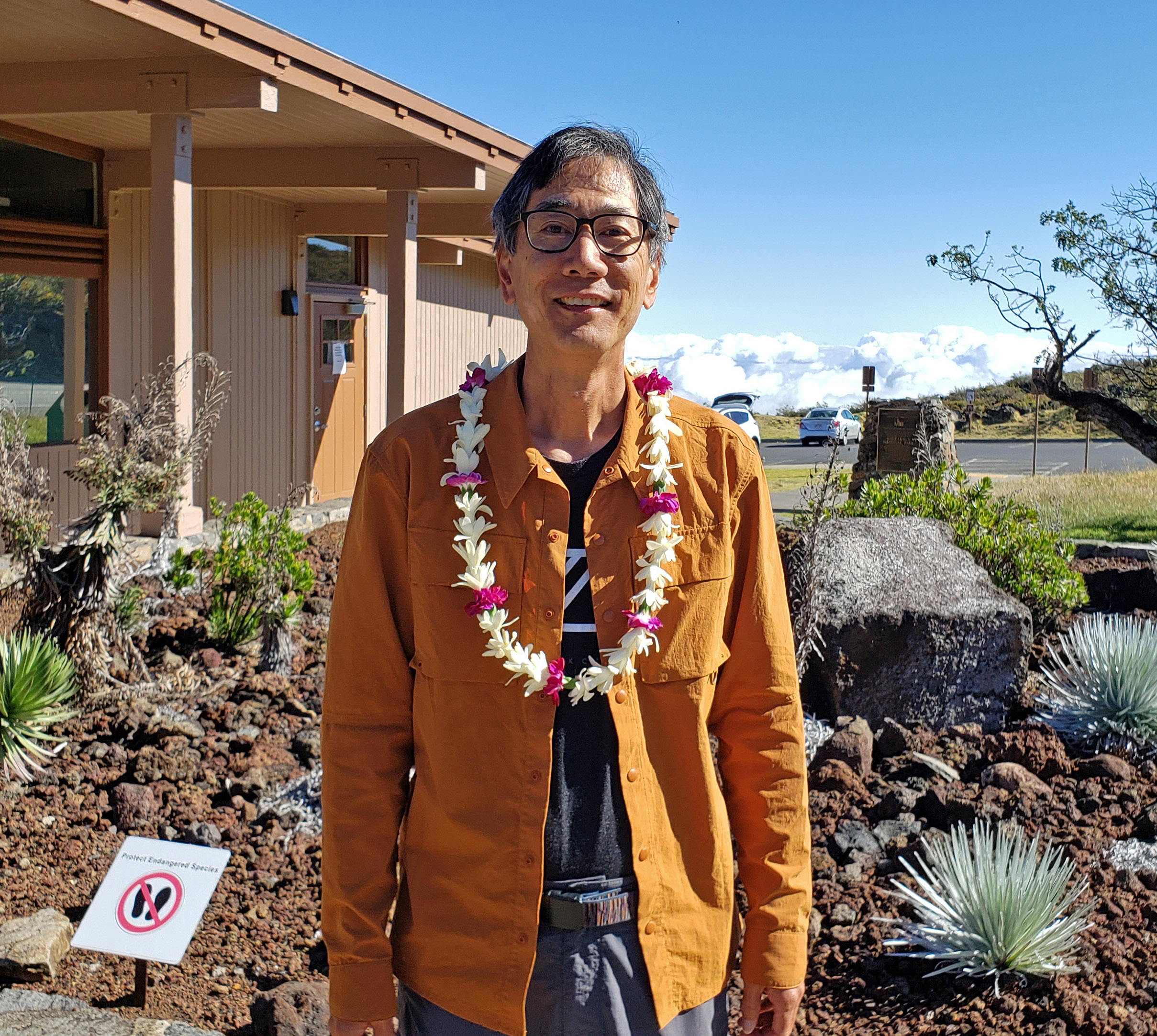
We both get presented lei at the ‘Iolani School Community Night talk
Ann and I were in Honolulu last week without anytime to post to the blog. Not on vacation, but working as the ‘Iolani School 2019 McDowell-Oda Chair for Communications and Journalism. Christine, an old friend of Ann’s from the AP who has worked in Honolulu for many years, had recommended several journalists to the teacher at ‘Iolani in charge of the chair. The school liked the various subjects I’ve worked to photograph over the years and extended the invitation before I left for Maui. They asked that I speak to the students in various classes such as photography, U.S. History, Race and Social Justice, Advanced Placement History. It was an honor to be chosen and speak at the private high school (Barack Obama went to the other well-known private high school in Oahu, Punahou).
Instead of returning to New York at the end of my Haleakala stay, I took a short flight to Oahu. Ann was able to come April 1 and spend the week. I had a full schedule of classes, 3-4 a day, but it was fun to meet the students and find out what they are learning. Ann was able to see the Honolulu Museum of Art and the Bishop Museum while I was at the school. Of course, I was presented with several lei during my stay by the teachers and have quite a collection. Ann was also given one at the Thursday night Community Night talk I gave.
The only drawback was that I got incredibly ill in the middle of the week. I had been feeling odd since Tuesday afternoon but thought it was minor. On Wednesday after the classes I really felt bad. Ann thought my forehead felt hot and bought a thermometer. It read 103.3 degrees! So she immediately got me to an urgent care center located in a nearby hotel. By then I was over 104 degrees, the nurse and doctor were surprised. The doctor thought I had the flu by the symptoms but a blood test didn’t show any. They gave me a large amount of Tylenol for the fever and an IV of water. After a few hours I felt better. Originally, I was put on the Tamiflu medicine. Friday morning I called about a lab test that came in. They said I had campylobacter, which you usually get from undercooked meat. So food poisoning. Ugh. I only missed a few of the classes and was able to solder on through the Community Night talk and two Friday classes. Then my stay at ‘Iolani was done. On Cipro now and I do feel much better.
The school, teachers and students were all great. It was a good experience to present the talks for all the classes.
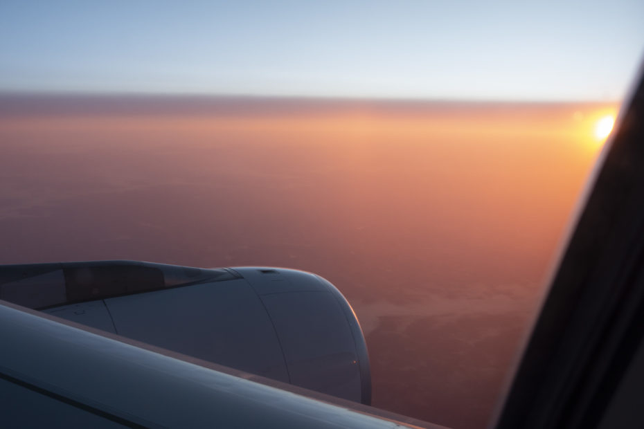
Ann and I managed to get lots of macadamia nuts for gifts, among other things, and find really nice aloha (Hawaiian) shirts. We said Aloha to Hawaii on Saturday and returned home, seeing the sun set and then rise on the same flight.
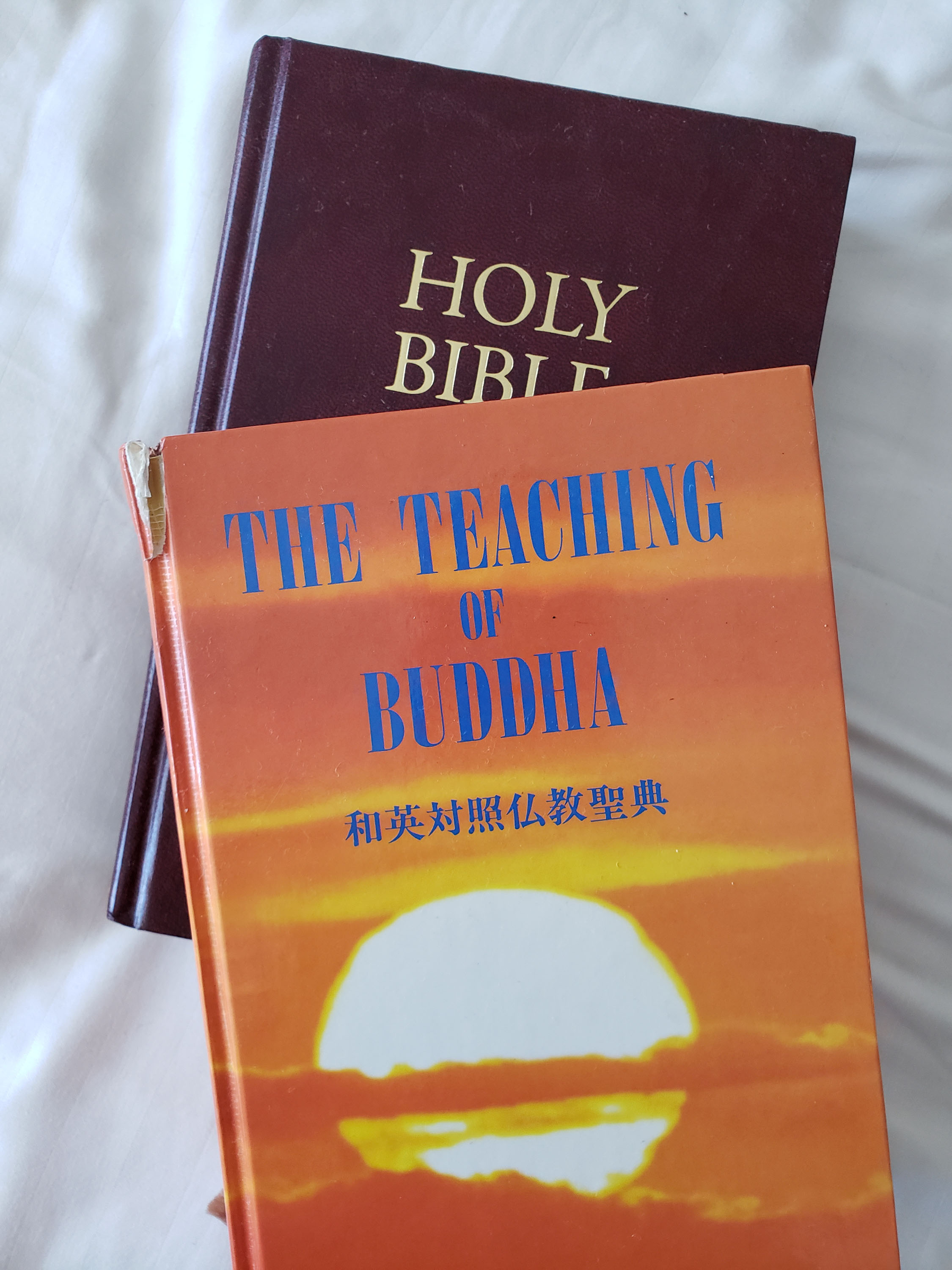
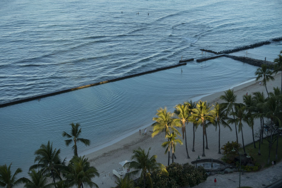
You know you’re in Hawaii when you see The Teachings of Buddha in with the Bible. Waikiki sunrise on the day we leave. A hazy orange sunrise greets us as we approach New York Sunday morning.
The beautiful lei of real flowers given to me by ranger Honeygirl. Aloha Honeygirl and Haleakala!
Last Friday was my final day of the residency and I said aloha to Haleakala and the rangers. Honeygirl gave me a parting gift of a beautiful lei, this one made of real flowers! It was an amazing month and I still have to sort through the many photos I took. I headed down the mountain to Kaluhui for two days. I extended the stay in Maui for a day because I got an invitation from park superintendent Natalie to come to a diner gathering at her house on Saturday night. Then I head to Ohau for another adventure.
I forgot to write about two night sky photography workshops I did at the park headquarters visitors center on March 23 and 24. The rangers were quite happy to host the workshops, they announced the first one and it quickly sold out- reaching the 20 maximum participants quickly and many on a waiting list. We agreed I could do a second one the next night and that filled up fast. Many of the students were from Maui, they could easily drive up to the park any time and practice. I did a short tutorial on camera controls and settings and we headed up to the summit just before sunset.
After over a week of pristine skies over the summit, the weekend brought very high clouds (higher than the 10,000 ft. summit) which threatened the view of stars. The clouds did produce two spectacular sunsets each evening of the workshops. But as night fell, a hole appeared almost straight overheard both nights, and we got views of Orion and the bright stars around it. Everyone was able to get photos of the stars.
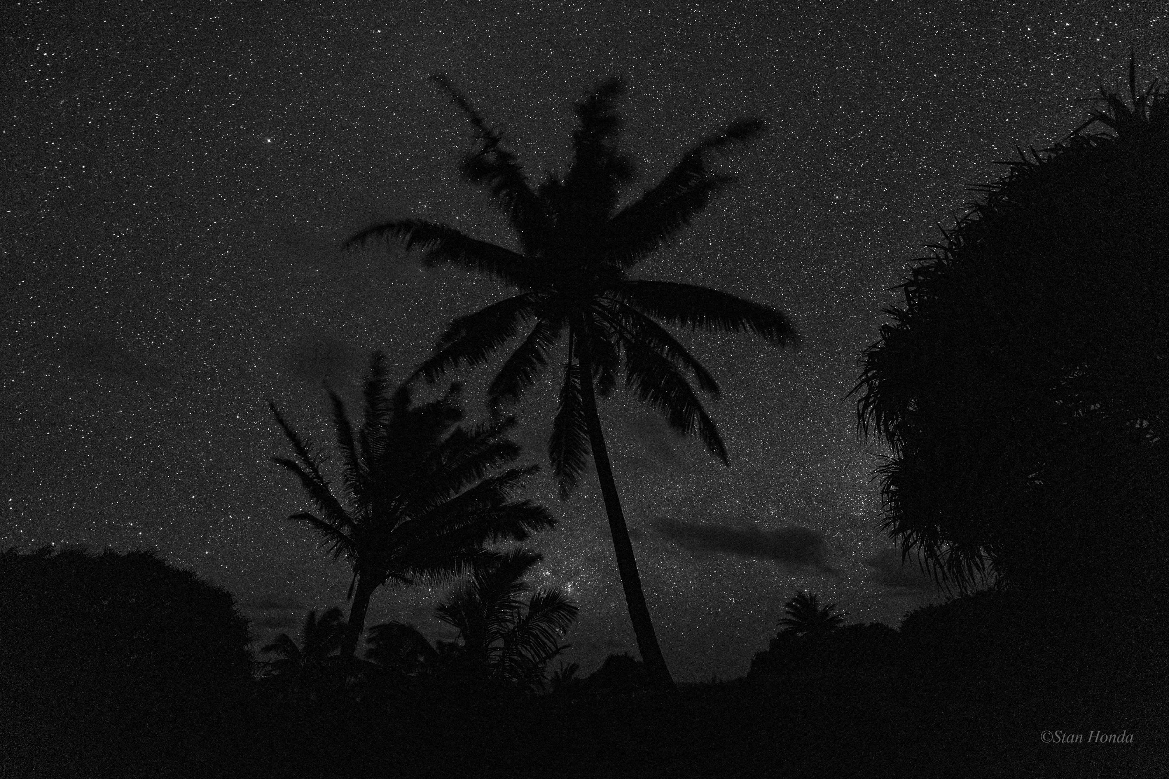
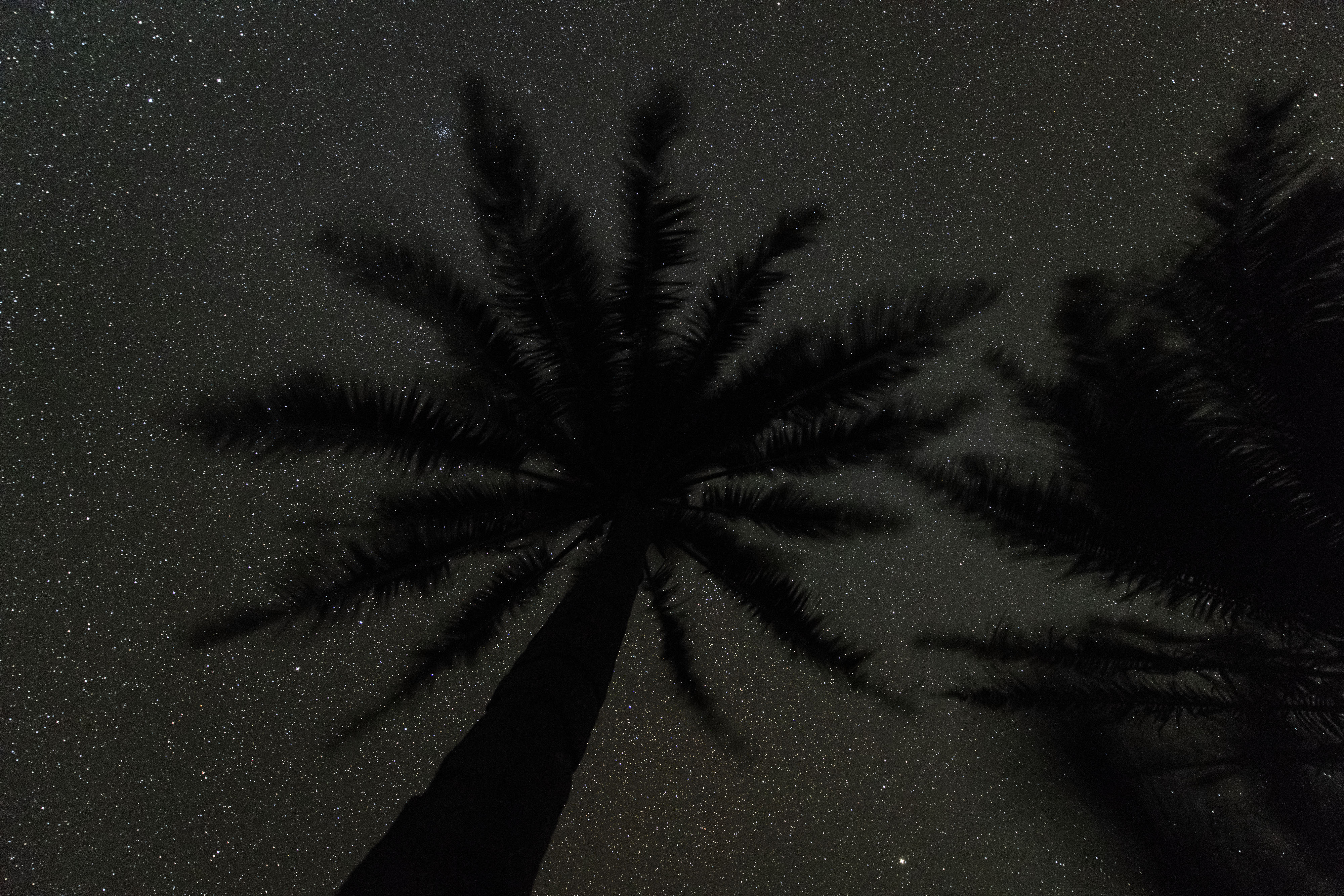
Below, some more night sky photos. From Kipahulu here’s a black & white version of the coconut trees looking south. There was so little color in the photo, it seemed to look best this way.
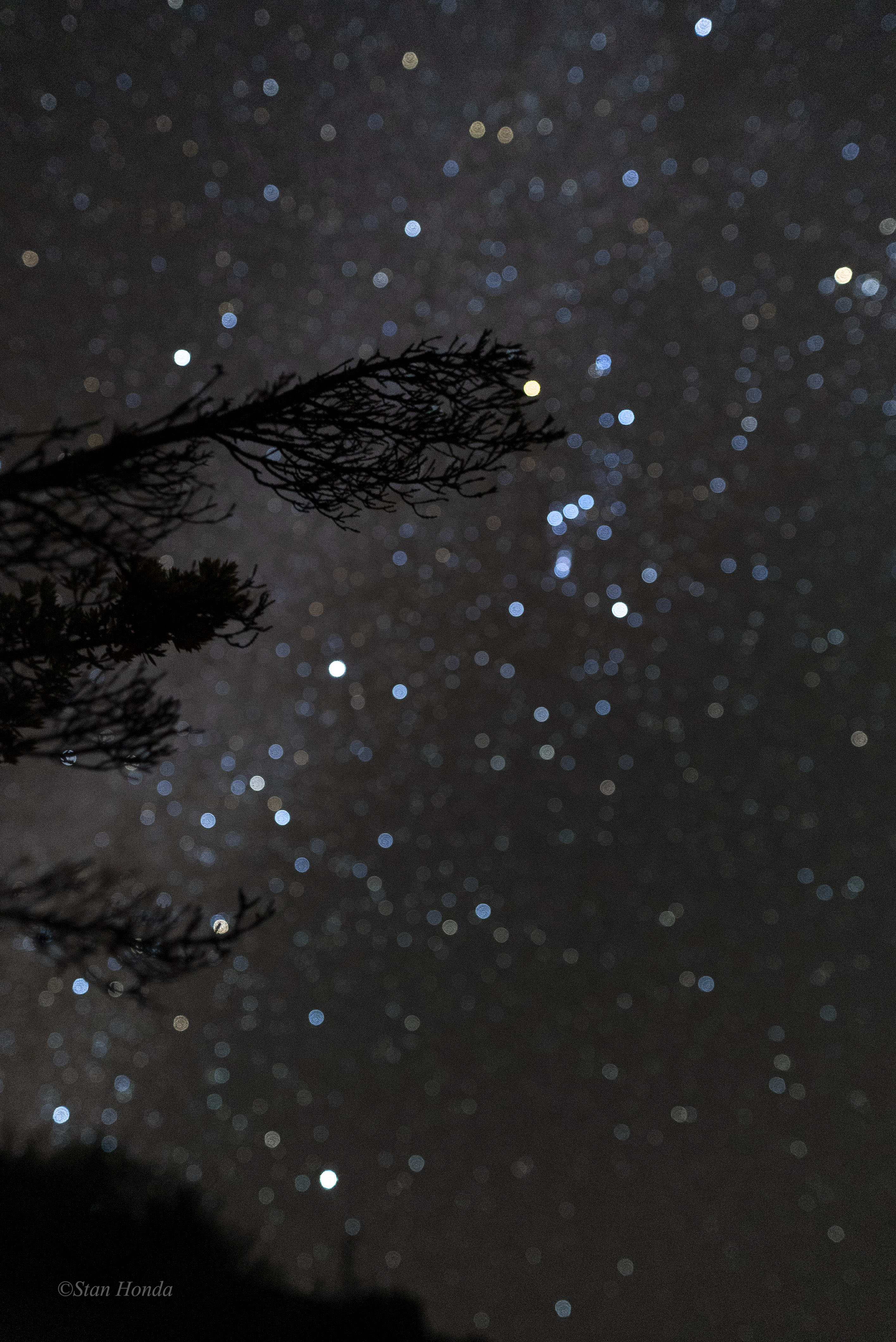
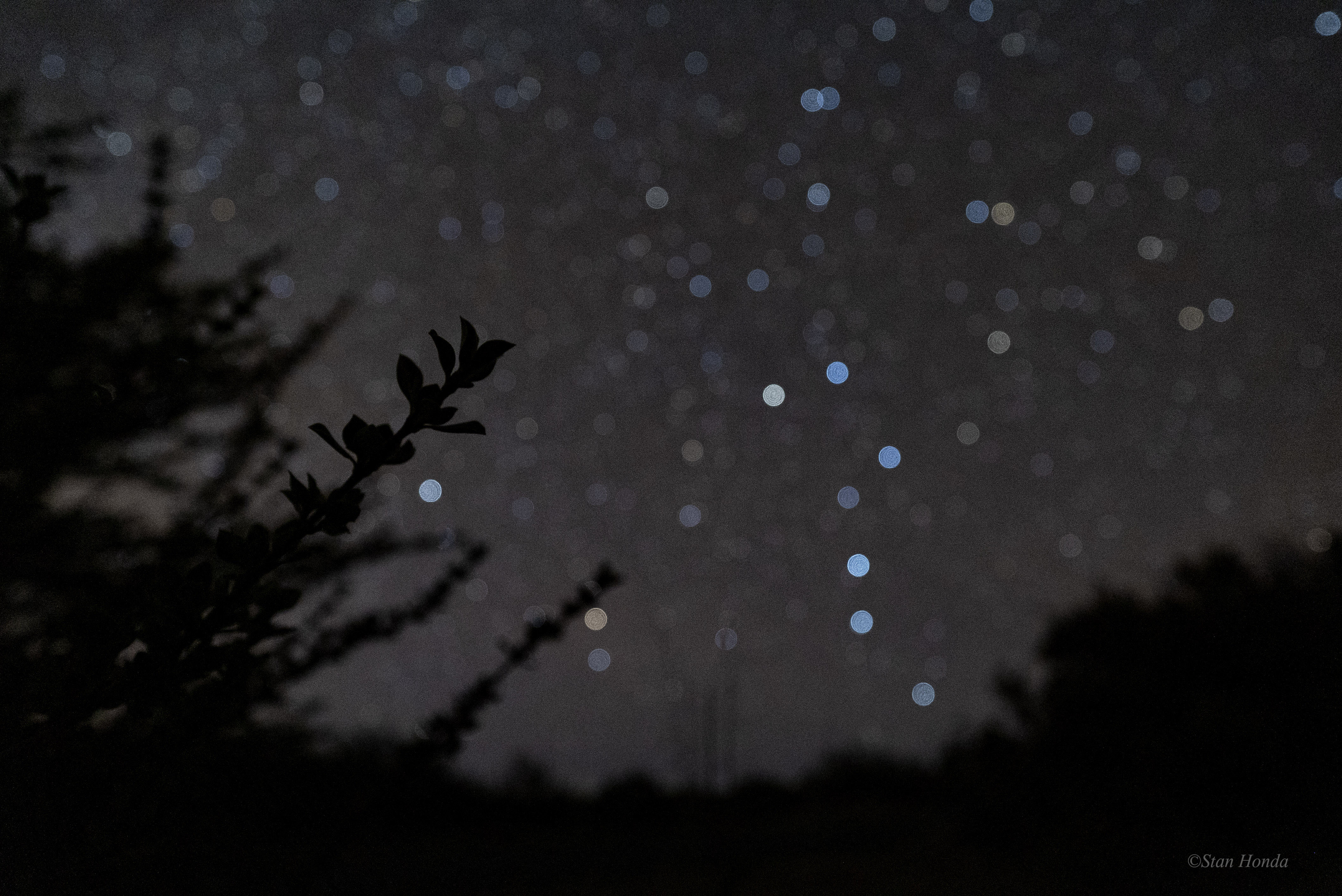
And from the beginning of March, I shot these ‘botanicals’ in Hosmer Grove, near the apartment and never posted them. You can see the familiar patterns of the Orion constellation and the Big Dipper.
Coconut trees in Kipahulu, the view looking south. (click to enlarge image). A pukiawe plant, in the background is the constellation Orion near the top branch, the bright stars Sirius (about in the middle left) and Canopus near the horizon. Canopus is usually thought of as a southern hemisphere star, at low latitudes in North America it can be seen.
A pilo shrub and the northern sky with the Big Dipper standing on its handle, two stars in the ‘dipper’ pointing towards Polaris, the North Star.
Starry night over a coconut tree. (Click on images to enlarge)
Many people have told me and Ann, “If Stan is in Maui, he has to take The Road to Hana!” A return trip to the Kipahulu section of Haleakala was in my plans, so this past Monday I set out. Various rangers and locals told me, “Don’t take the north road (The Road to Hana)! Too many tourists and it’s slow going.” A ranger at Kipahulu suggested taking The Road to Hana when I return, then the quicker, shorter south road going back to the summit area. My friend Ken had taken The Road to Hana with his family on a visit last year, he did say it was scenic but very slow. We decided if I’m here and going to Kipahulu that if I don’t take The Road to Hana, people back home will make fun of me. So three and a half hours later (for 75 miles), I arrive at the Kipahulu bunkhouse. The Road is very curvy and you drive through some amazing dense foliage, gorges and past waterfalls. There is a bamboo forest that is incredible. You don’t get many views of the coast and it is quite slow going. The panoramic views of the ocean and coast from the south road are hard to beat and I took that road back to the summit.
I settled into the bunkhouse and enjoyed the incredible scenery and solitude (a break from the solitude at the summit housing). It was warmer and more humid than my first trip there at the beginning of the month (blog post from March 8). The first night was not so great as rain interrupted the shooting. By the time I got back to the bunkhouse, it was pouring.
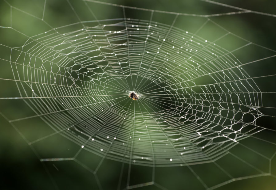
On Tuesday I got a roommate. Early in the morning as I was shooting a spider web off the lanai a visiting ranger arrived. Aaron is an electrician and works full-time at Mt. Rainer National Park in Washington. He has come to Kipahulu several times and is here to help with solar arrays and various electrical projects.
When Aaron returned to the bunkhouse after his day’s work, he suggested a walk to the point that we see from the house, I didn’t know you could access it. He said he found it on a previous trip by walking down the road a bit and seeing a small gate with a National Park Service sign on it. The trail is not advertised and is not in any park literature. The walk goes through grasses and through closed in trees and foliage, then opens up on to the point as you walk on crushed lava. Very small green plants grow between the lava making a great contrast. The view is really spectacular, compared to the ‘just spectacular’ view from the house and the other parts of the park. The ocean is on three sides and you can see the top of Haleakala partly shrouded in clouds. We arrived near sunset and it was very pleasant.
Tuesday night was about as clear as it can be for Kipahulu. Starting out pretty clear, my southern-facing time-lapse suddenly had a long dark cloud intruding into it. When that was done, I headed to the view of the ‘Ohe’o Gulch with a couple of waterfalls and several pools of rushing water. The moon rising in the east at 12:35am lit up the gulch as I had thought, between the clouds meandering across the sky. I shot for an hour there, then headed back to the bunkhouse.
Wednesday morning I headed back on the south road to the apartment in the summit area. The car thermometer reached 78 degrees as I drove through the Kipahulu area along the coast. When I reached the apartment at 7,000 feet, it was 58 degrees.
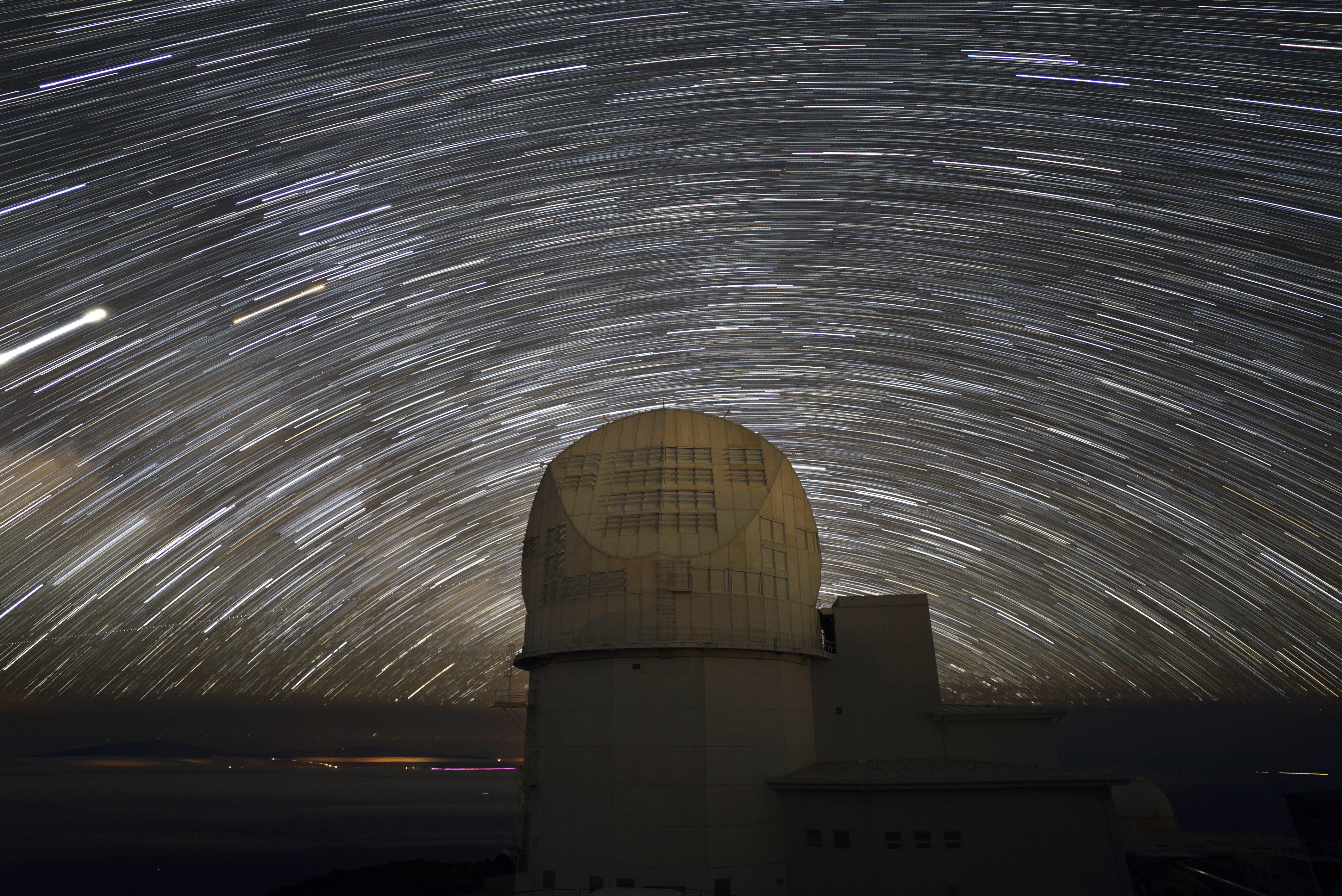
During the daytime I’m slowly sifting through the images and working on them. Earlier in the month I shot a sequence for a star trail picture over the Daniel K. Inouye Solar Telescope. I just put it together and it turned out a bit better than I expected (below).
A spider and its web on the lanai of the Kipahulu bunkhouse after a light rain. (Click on images to enlarge)Plant life between the hardened lava. Star trails looking south over the DKIST at the observatory. (From earlier in the month)